Abstracts and Speakers
Tuesday, 25th October 2016
Tuesday 0915: Opening Address: The barriers to and benefits of managing information as a business asset
Speaker: James Price, Managing Director, Experience Matters
Abstract
Information is the arterial system for organisations, supplying the nutrients for all business activities, processes and decisions. With increased access to information creating digital disruption on one hand and unprecedented opportunities on the other, not only is managing data and information effectively business-critical but without high quality information no organisation can function well. In most organisations the management of the technology infrastructure is done professionally whilst the management of the information it delivers is done badly and at significant cost.
This presentation will help Information Management professionals explain:
- What Information Assets are and why they are so important
- How Information Assets are managed.
- The reasons why information is managed so badly.
- Why it matters to organisations and their operation and therefore why the senior leadership team should pay attention
- What to do about it.
James will draw on the findings of a research project that Experience Matters, in conjunction with the University of South Australia, is conducting into “The Barriers to and Benefits of Effective Information Management”. The project is being run in Australia, South Africa and the United States. Gartner has described Experience Matters’ work as “tremendous” and the project and its findings as “ground-breaking”. Mike Orzen, winner of the Shingo Prize, which is described by Business Week as the “Nobel Prize for Operational Excellence,” has declared that it is “truly great work.” James will present the barriers to and benefits of managing information as a business asset that have been identified by C-Level Executives from organisations that include National Australia Bank, the City of Cape Town and Bell Helicopter, Boeing and Wells Fargo.
Speaker bio
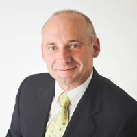 James Price is a business manager with 30 years’ experience in the information industry. He is the founder and Managing Director of Experience Matters, a firm of business advisers in the management of Information Assets. Having worked for a multinational hardware and software vendor, a software developer and a systems integrator and been the Chair of the Board of a Arts company and Group Managing Director of three medical firms, James formed Experience Matters to address the problem that, whilst Information Assets are vitally important to organisations, by and large they are very poorly managed. Experience Matters has since worked for, and delivered measurable benefits to, national and multinational corporations and all levels of government. James is internationally recognised as an author of peer-reviewed papers and a presenter to business and academic conferences.
Tuesday 1000: Techniques: Harnessing 3D Design, printing and scanning in hydrography
Michael Whiting, Water Resources Assets Project Manager, Department of Water WA
Abstract
The Department of Water’s Hydrologic Technology Centre (HTC) provides instrumentation and assets internally for both long term and project based measurement of Western Australia’s surface water and groundwater resources.
The HTC integrates a wide range of hydrographic instrumentation including transducers, data loggers, communication systems and power systems from different suppliers along with instrument mounts and site infrastructure for hydrographers to install and use in the field.
Since the mid-1960s these items were drawn using ink pens and drafting film. This was replaced in the early 1990s by Autodesk® Autosketch® computer software.
Over the years fabrication was done in-house, which required qualified machinists and workshop facilities. With increasing pressure on resources, fabrication was systematically outsourced requiring accurate documentation for contractors to follow.
In an effort to improve this process and reduce costs a more robust industrial approach to design and documentation has been implemented. The process uses 3-D design software, 3-D printing and 3-D scanning technologies.
Using 3-D design software requires an item to be modelled in a virtual 3-D space, which is then used to produce accurate drawings and outputs for computer controlled laser cutters, benders etc., all of which are handled in the one computer application Autodesk Inventor®.
Although visualising a product on screen is possible, having a physical object to trial its use is far more effective. However fabricating prototypes to trial a design can be very expensive. 3-D printing is a technology that has become more common place and more cost effective alternative which allows items to be replicated quickly in plastic resin, tested, re-designed, and 3-D printed again as required before finalising the design.
Complex items either don’t have electronic drawings available or the cost of modelling the products from manual measurements is cost prohibitive, so 3-D scanning was trialled. 3-D scanning is undertaken by taking snapshots of the surface of a product and an electronic model of the surface is developed which can then be used to design other items to fit or integrate effectively.
The paper will not only provide an overview of the technology, processes and challenges faced in adopting this 3-D design and documentation approach to instrument mount and site infrastructure design, but also provide real-world hydrographic examples of how these technologies have been used to great effect.
Speaker bio
 I began my hydrographic career in 1989 at the Water Authority in Perth Western Australia, in Bauxite Research group, and then the North West Region from 1992.
I returned to Perth in 1997 to complete a Diploma in Civil Engineering, whilst working as a Hydrographic Consultant for Greenbase Consulting Pty Ltd. I joined the Water Corporation in 1999 managing a small Instrumentation and Systems team.
In 2006 I joined the Department of Water as the Surface Water Asset Manager to oversee the asset design, construction, and maintenance program of 350+ surface water gauging stations.
I am currently the Water Resource Assets Project Manager at the Hydrologic Technology Centre at the Department of Water managing a team responsible for delivering quality measurement Instrumentation and Assets including network of Internet Protocol telemetry systems.
I am a member of the Australian Hydrographers’ Association, and have also been Committee Member (2002-2011) and Secretary (2005-2011).
Tuesday 1100: Techniques: The Internet of Things: A New Start
David Hammond, Sales and Business Development Manager, Campbell Scientific Australia Pty Ltd
Abstract
In July 2016, the first fully connected city wide LoRaWAN™ Internet of Things (IoT) communications network in Australia was launched in the city of Townsville, North Queensland.
Townsville, which is part of the IBM® Smart City Initiative, now has a world class IoT network, with an area of coverage of approximately 1000 square kilometres. But what exactly is the IoT? How could a LoRaWAN™ IoT network benefit our industry, and how could it be utilised in our day to day operations? This paper attempts to explain the IoT using the Townsville LoRaWAN™ network as a working case study. It shows how different industries can and are benefiting from having access to an IoT network, and investigates how a LoRaWAN™ IoT network could benefit the hydrographic industry. The development of LoRa® technology brings a whole new spatial scale to IoT applications, and the overriding aim of this paper is to encourage and stimulate further ideas and discussions amongst hydrographers about how the hydrographic industry can fully leverage the potential opportunities that the IoT offers.
Speaker bio
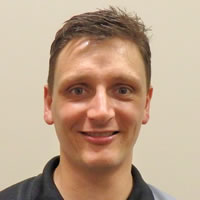 David Hammond is Sales & Business Development Manager for Campbell Scientific Australia. David studied a Masters in Applied Meteorology and Climatology at the University of Birmingham in the United Kingdom, and a PhD in Transportation Meteorology, funded by Weather Services International, North America’s largest Private weather forecasting agency. The research from this PhD is now enabling transportation authorities across Europe and the US save millions of dollars every year from reduced salt usage during winter maintenance operations.
David has worked at Campbell Scientific for 12 years, initially as a Research Engineer at their European Office in the United Kingdom, developing sensors and communications devices used for road ice prediction, and for the past 6 years in Australia where he has worked in Application Engineering and most recently Sales & Business Development. David is also an Executive Committee member on the Standing International Road Weather Commission.
Tuesday 1130: Techniques: Unravelling the IoT
Matthew Henderson, Product Development Manager, Ventia
Abstract
In the last 3 years a revolution has been starting in the area of wide area data collection. Low Power Wide Area (LPWA) technologies have started to emerge that promise to deliver an “order of magnitude” reduction in the cost of remote monitoring. Already starting to get a foothold in domestic water utilities – Mackay Regional Council has deployed 36,000+ devices to monitor domestic water consumption across the region in near real time.
As the sector has started to grow, a range of technologies and service models have emerged promising to deliver the nirvana of the “Internet of Things” (IoT), resulting in large volumes of devices (in bores, rivers, irrigation channels etc.) able to be monitored real time at low cost.
The competing technologies range from existing mesh solutions such as Zigbee and Silverspring, to emerging true LPWA networks such as Taggle, Sigfox and LoRaWAN, and the impending entry of the LTE (mobile) aligned technologies such as CatM and NB-IoT (now known as Cat-M1 and Cat-M2). While all of these technologies promise a lot, in reality they have quite different capabilities and economics the selection of the right technical solution very complex decision making environment for a practitioner to navigate.
In addition, the market is currently being pursued by a range of entrants, from the major Australian Telecommunications companies, to technology and software providers, and a host of local start-ups. As a result, not only is the selection of the right technology complex, but determining the right service provider and delivery model is also very complicated for most water management companies.
This paper will discuss the realities of the different technologies and business models being brought to market. It will help to separate the fact from the marketing hype and provide a framework for understanding what the likely long term robust solutions will be, enabling practitioners to make a low risk assessment of the options becoming available.
In doing so the paper will demonstrate the potential cost reductions available in remote monitoring, as well as describe how these cost reductions are achieved both at a technology and business model level. We will use existing trial installation to demonstrate the technical capability of emerging LPWA solutions in a range of applications including bore and sewer monitoring.
Finally, we will explore the likely benefits of moving towards a highly connected water management environment, and how these technologies are likely to change the way water resources are managed in the future.
Speaker bio
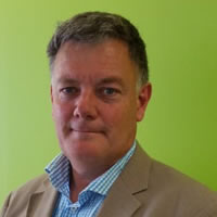
Matthew has more than twenty five years’ experience in senior roles in wireless and semiconductor ventures.
After graduating from Sydney Uni, Matthew spend a number of years working for Schlumberger in the Middle East logging oil wells before returning to Australia to run Toshiba’s Product Development, R&D and manufacturing in Australia.
Matthew went on to found Klaxon and built a global wireless network business monitoring the condition of produce in refrigerated shipping containers.
9 years ago, Matthew founded and was the Chairman of Taggle Systems, and together with Chris Andrews built Australia’s largest LPWA network providing automatic metering to many water utilities across regional Australia.
Matthew has won the Percey Innovator of the Year award, the Motorola wireless innovations award, the Telstra Startup award and Tech23.
Matthew is currently responsible for IoT products in the Vianet innovation team within the Ventia Utility services group that is focused on helping clients assess, deploy and leverage next generation IoT solutions to drive down the cost of widespread data monitoring, and place an increased focus on data driven decision making in organisations.
Tuesday 1200: Techniques: Telemetry: Cell Phone and Satellite
Matt Saunders, General Manager, Unidata Pty Ltd
Abstract
This is a technology update on different technologies for telemetry for water sensor data. The industry now calls these Machine to Machine (M2M) and als refer to them as the emerging Internet of Things (IOT) sector
The presentation will initially cover cell phone telemetry technologies, 2G 3G & 4G( LTE) and the emerging private 4G(LTE) sector. The presentation will also cover the available satellite based telemetry systems, including Inmarsat, Globalstar, Iridium Orbcom and Thuraya, and their product offerings and capabilities. Finally there will be a presentation on Internet security as it relates to these technologies.
Speaker bio
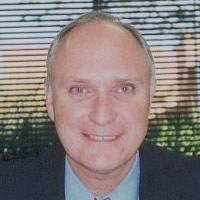 Matt Saunders is the General Manager of Unidata Pty Ltd, a long established environmental monitoring and industrial measurement manufacturer.
Matt Saunders has more than 25 years of senior management experience in the electronics and software industry. This has included software development, research and development electronics design ,project management and manufacturing.
Matt has been an active member of the Institute of Radio & Electronics Engineers (IREE) and the IREE Communications Society. (IREE COM SOC) for many years.
Tuesday 1330: Techniques: Emerging technologies and techniques for aquatic pollution detection and management
A/Prof. Vin Pettigrove, CEO CAPIM, Research Fellow School of Biosciences, University of Melbourne
Speaker bio
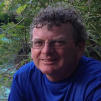 Dr Pettigrove is the Chief Executive Officer of the Centre for Aquatic Pollution Identification and Management (CAPIM) and a Principle Research Fellow in the School of BioSciences at the University of Melbourne. Under his management, CAPIM has become internationally leading organisation in the research and management of freshwater and marine pollution issues, including catchment management and pollution sourcing. Over the last 30 years, Dr Pettigrove has played an integral role in Australia’s water industry, having contributed to the transfer of research outcomes into environmental management programs and strategies. His accomplishments include the establishment of water quality, macroinvertebrate and fish monitoring, and research programs on native fish for Melbourne Water. Other areas of research comprise the assessment of sediment toxicity in relation to urban runoff, the effects of sediment pollution on aquatic macroinvertebrates and the development of methods to assess aquatic ecosystem health. Dr Pettigrove is a Principal Investigator on 4 Australian Research Council Linkage grants and has 74 peer-reviewed publications. According to Web of Science, he has 637 citations, an average citation of 10.11 per item and a H score of 15.
Tuesday 1400: Techniques: Water in the Cloud
Ben Starr, CEO, Eagle.io
Abstract
The Queensland Department of Natural Resources and Mines (DNRM) is using a cloud IOT platform to solve a data challenge in administration of the water allocation scheme in Oakey Ck catchment, Queensland.
Prior to 2014, water harvesters in the Oakey Ck catchment extracted water under a licence. Under the licence conditions, extraction volume and timing was self-administered by harvesters, by physically assessing flow depth at the take point from a physical gauge.
DNRM transitioned to a centrally administered program in August 2014 due to increase demand on water, driving need for a robust and centrally administrated program. Under this program, Water Harvesters were permitted to extract water when it flows at the immediately upstream weir (constructed, maintained and monitored by DNRM).
To administer this program it was necessary for DNRM to access a platform that could ingest and store and share flow data from weirs, and trigger alerts to landholders when their individual water allocation conditions allowed for extraction.
- The needs for the solution were to alert water harvesters to the presence of flow at an upstream gauging station (via SMS), and
- Provide water harvesters with access to real time flow data to monitor the flow,
- If the flow threshold is met to provide water harvesters with the necessary information to calculate the volume of water that may be taken based on the period of time the flow is above the threshold and their approved rate of take.
The paper summarises the need to apply a cloud data technology, how the platform is used by both water harvesters and the Department of Natural Resources and Mines, and the potential for future further automation that cloud technology allows, like remote actuation of pumps and flow monitoring of take by individual water harvesters.
Speaker bio
 Ben is an environmental scientist with an interest in applying technology to solve environmental problems.
He is currently CEO of the remote monitoring cloud software platform eagle.io, and contributes to the Integrated Urban Water Scientific Expert Panel, run by Healthy Waterways.
He has previously been managing director of O2 Environment + Engineering, a Qld based water engineering firm, director of the Australasian Chapter of the International Erosion and Sediment Control Association, and a sessional lecturer at Griffith University.
He has a bachelor of science and a Master’s in Business Administration.
Tuesday 1530: Techniques: Digital Signal Processing and Water Sector Instruments
Ray Godley, Business Owner and Researcher, Sonflo UK
Abstract
This session will outline techniques associated with digital signal processing ( DSP) and how these affect our daily lives in many ways.
The session will then outline how these techniques are now used widely in water measurement instrument design and manufacture. The session then will outline a DSP module & describe how it works; and how this is applied in a real life example for an acoustic measuring instrument.
The session will also provide some history as to the growth of digital signal processing and the emerging new DSP components which facilitate the design of acoustic water monitoring instruments.
Speaker bio
 Ray Godley was the founder of Unidata, when the company was set up as a joint venture with the University of Western Australian in the late 1970s. Ray departed Unidata around 20 years ago but maintains close contact with the company in the research area of ultrasonics. Ray lives both in Australia and the UK. He has continued his research and development activities in the field of ultrasonics over many years. Ray collaborates with and performs research work in ultrasonics with colleagues from the University of Cambridge.
1600: Smart Phone Apps in Ground Water Field Data Collection
Rob Armstrong, Project/Contract Manager, Environmental Services, Ventia Utility Services
Abstract
Objectives
The use of traditional paper field sheets means a duplication of effort and potential for the introduction of transcription errors, with handwritten field data generally being manually typed into a database. We set out to develop our own custom smartphone application to streamline the scheduling, collection and presentation of groundwater monitoring data. The use of smartphone apps can provide an intuitive workflow for technical staff to collect environmental data in the field, ensuring nothing gets missed, and providing information to fieldstaff as they move through the workflow. Rather than being controlled by separate systems, the workflow can also integrate controls on safety, quality, environmental and legal requirements of any field-based task
Design and methodology
Our app (via a smartphone or tablet) integrates with a server-based SQL database and can exchange data in either direction whenever there is appropriate mobile data coverage. The application utilises the device’s location services (GPS), data services and camera to deliver the following key features;
- Nearest bore – Identifies the bore closest to the user. This feature greatly reduces the likelihood of data being entered against the wrong bore ID and proximity warnings are displayed if the user attempts to enter field data when not physically at the expected location.
- Historic data graphs – Historic data is presented to the field officer as a reference. The current reading is plotted instantly on the hydrograph to allow for real-time field data validation against historic measurements.
- Photographs – Automated categorisation and naming of photos.
A series of supporting web-based applications have also been developed, allowing administrators to interface with the database to schedule tasks, check metadata and validate monitoring data.
- Web-based database – Used by Project Managers to plan runs, schedule work, optimise routes and review safety systems. Stores all historical records as soon as they have been collected in the field.
- Data validation – Used by Data experts to view the measurements collected in the field and check them against the historical record. Accept, amend or reject measurements for release to your client. Check and add comments before release.
- Data viewing portal – Used by clients and Project Managers to view monitoring data, photographs, maps and other bore metadata. Check photos prior to being released to the client.
- Image Manager – Search for bore photographs by date, bore or photo type.
Conclusion
Smartphone technology is being used as the platform for a custom developed application that has streamlined the collection of groundwater data from the field, resulting in improved efficiency, safety and data quality. By comparison with ‘off the shelf’ alternatives, working closely with a developer has made it possible to tailor solutions specific to requirements.
Speaker bio
 Rob has over five (5) years’ experience working in the Environmental Services industry and experience managing projects, facilitating training programs, monitoring environmental assets, delivering EHS improvements and managing contractors.
He has experience managing projects for a range of clients including natural resource management bodies, water utilities, local authorities, waste management bodies, mining companies, construction groups, and state regulatory bodies.
Tuesday 1630: Techniques: Safety in Hydrography – The impact of innovation and technology
Allan Garland, Senior Environmental Engineer, Ventia
Abstract
In the hydrographic industry our staff are both our most precious asset and greatest resource. Like with all other industries it is necessary to expose our staff to a variety of hazards to collect the data our business and clients require. How we identify and control these hazards to reduce exposure risk is essential to ensuring the ongoing health and safety of our workers.
In the last decade new technologies and smart initiatives have introduced a wide variety of safety innovations to the hydrographic industry. These innovations impact the way we identify hazards, and how we determine the most appropriate control. Of a greater benefit, the technology and initiatives have opened the door to a suite of new innovative controls available to the industry today.
To identify hazards Ventia has introduced smart hazard identification tools based on energy sources integrated into a modified START card, and further enhanced through smart phone integration. In any incident, it is the uncontrolled state change of an energy source that is ultimately the source of the hazard. By identifying and controlling the energy sources, the tool provides workers with both a system that allows previously hidden hazards to be identified and effective controls to be implemented.
Through significant advances in technology and innovation over the last decade, a suite of new options to control hazards is today available to all Hydrographers. Many tools such as improvement in vehicle safety, the development of tracking and alert systems, and safer tools and equipment have been developed for use across multiple industries. These controls are often introduced through natural attrition of old equipment or introduced as new strategic safety measures. The introduction of the SPOT personal tracker to the business is a key example of a strategic new control measure that has had a dramatic impact on the way we monitor and support our staff in the field. Other systems have been developed specifically for the Hydrographic industry and include examples such as the variety of acoustic flow meters. The use of these units in place of traditional measuring gear dramatically reduces the hydrographers reliance on excessively heavy cableway equipment and eliminates the manual handling issues that hydrographers traditionally faced.
To complete the hazard identification and control process, Ventia operates a continuous improvement cycle. This cycle drives innovation and improvement, and is essential to ensure we can identify and introduce new measures to further protect our workers in the future. This proactive approach to safety also leads to a workforce with an exceptionally strong safety culture. This culture empowers our employees to continually act in a safe manner in the knowledge that their employer considers their safety above all else.
Speaker bio
 Allan has over thirteen years of environmental monitoring experience across New South Wales, Victoria and Queensland. He has operated and managed a wide variety of environmental monitoring projects including surface water monitoring, groundwater monitoring, occupational hygiene monitoring for mining and remediation clients, road side flood warning network installations and environmental monitoring for local waste recovery centres and landfills. He has excellent skills using a wide variety of precision instrumentation. He has also undertaken advanced training courses for the instrumentation used for monitoring and worker safety monitoring.
He has spent four years in Ventia’s Environmental Services Research and Development group. During this time his role was to research, test and install new instruments, tools and systems, improve works procedures, and provide reliable technical support to field staff.
Allan’s current role is a Senior Environmental Engineer within Ventia’s Environmental Remediation group in Sydney. He is responsible for the implementation and management of Ventia’s environmental monitoring systems at project sites throughout Australia. Many of the systems he maintains are used to directly support worker safety most commonly through early warning of adverse environmental conditions.
Allan utilises his diverse skill set to undertake projects with complicated operating and SHEQ conditions and data requirements. He is a senior member of the HSE Leadership Team and actively involved in promoting safety in the workplace.
Wednesday, 26th October 2016
Wednesday 0900: Technical Workshop: Estimation of Type A uncertainty of moving-boat ADCP streamflow measurements.
Hening Huang, Asia Pacific Manager & Principal Hydraulic Engineer, Teledyne RD Instruments,
Abstract
This paper considers the Type A uncertainty of streamflow measurements with an acoustic Doppler current profiler (ADCP) mounted on a moving-boat or float under steady flow conditions. A recently developed median-unbiased uncertainty estimator is recommended as the Type A uncertainty. The Type A uncertainty is calculated using transect discharge data collected at a site. Therefore, it accounts for all sources of random errors in discharge measurements at the site. This paper proposes a Type A uncertainty control chart for statistical quality control of moving-boat ADCP streamflow measurements. A new statistical quantity, named the degree of certainty (DC), is presented as a measure of the certainty about the measurement quality with respect to the uncertainty-based quality control criterion.
Speaker bio
 Hening Huang is the Teledyne RDI expert in hydrography, holding a Ph.D. in Environmental Hydraulics from UC Santa Barbara along with over 25 years of experience in the industry. Hening also serves as Teledyne RDI’s Australia connection; supporting our representatives and customers in the region, and offering training or demonstrations when needed. Hening shares an understanding with his customers, as he was once a customer himself. He too remembers being amazed by the revolutionary ADCP technology and the ease of gathering a larger collection of data. This was a remarkable leap forward compared to spending numerous days on a boat collecting minimal data with the old style current meters. Having spent many years using ADCP technologies and working with ADCP data for water quality modeling, Hening continues to use his background and knowledge to help with customers’ applications and product development. Although his focus is on the other side of the globe, he enjoys Southern California’s drier climate and diverse environments; which allow him to spend time gardening, fishing in the surf zone, enjoying sushi and practicing Tai ji all year round.
Wednesday 0920: Technical Workshop: Campbell Scientific’s new CR310 WIFI Data Logger – a low cost hydrological data logger with wifi and cellphone communications capability.
Gavin Hewitt, Application Engineer / Head Trainer, Campbell Scientific Australia
Abstract
The CR310 WIFI data logger will be available from November 1st 2016. This novel logger supports the standard range of communications options plus wifi. When used with Campbell Scientific’s free LoggerLink smartphone app, users will be able to view and collect data, set the clock, and download programs – all by using their smartphone or tablet. This means that you will no longer need a keypad / display or PC to conduct on-site maintenance, and you will even be able to access your logger when inside a sealed enclosure.
This short workshop will take you through the process of how to do this as well as demonstrating some of the neat features of this new, low-cost data logger from Campbell Scientific.
Speaker bio
 Gavin is Head Trainer & Application Engineer at Campbell Scientific Australia.
His Trainer Duties include Customer & Employee Training, Developing Internal training & skill development and organising training courses and developing new materials.
In his Application Engineer role, he is key account manager for hydrology and water quality monitoring applications, projects and development, and works on coastal monitoring system development, sSystem design and quoting, technical support and troubleshooting, datalogger programming, technical sales and on site support, installation and commissioning.
Wednesday 0940: Technical Workshop: “Innovative Applications of Communications in Hydrography” or “Internet of Things Decades Before They Became Internet of Things”
Stevan Palos, Director, Halytech
Abstract
Halytech has been developing and delivering leading edge Internet of Things solutions since 2001. The presentation will describe a number of real Halytech customer applications showcasing various communications technologies including:
- TCP/IP
- mobile telephone networks – 2G, 3G, 4G (LTE)
- satellite networks – Iridium, Thuraya
- GPS
- Peer-to-Peer networks
- Low power wireless mesh networks
- SCADA: Modbus, DNP3
Speaker bio
 Stevan has over thirty three years of professional experience in the environmental, information technology and communications fields. For the last fifteen years he has been the Director at Halytech. Stevan holds a First Class Honours Degree in Electrical Engineering from the University Of New South Wales.
Wednesday 1000: Technical Workshop: Asset Management and quality data
Peter Heweston, Elder Statesman, Kisters Pty Ltd
Abstract
The management of field instrumentation is central to the delivery of good quality data. In 2010 a national workshop was convened on the topic of asset and instrument management. The very definition of good quality data presupposes that field instrumentation is sited, maintained, calibrated and serviced in accordance with appropriate organisational, vendor and industry standards.
Peter Heweston will discuss some aspects of the instrument management issue, and demonstrate some solutions that have been developed in the intervening years.
Speaker bio
 Peter Heweston has been involved in the water industry since 1985, and is one of the developers of the Hydstra suite of software products. He continues to maintain an active role in software architecture and development within KISTERS Pty Ltd..
Wednesday 1100: Technical Workshop: End to End telemetry based solution – introducing Metasphere’s ‘point colour range’
Paul Hart, Metasphere
Abstract
Metasphere is a leading telemetry solutions provider, specialising in battery powered Remote Telemetry Units (RTU’s) that collect and transmit important data from remote or unpowered sites. When combined with ‘Palette’, our web based data visualisation and management platform we offer an ‘end to end telemetry and business data management solution’.
Our major clients including Sydney Water, WA Water Corp, QUU, TMR, Melbourne Water and Jemena refer to our RTUs as the ‘next generation’!
- 3G enabled
- IP68 – they can be submerged by 4m for up to 4 days and continue working
- Low battery powered units, ideal for remote locations. Battery life of 5+ years.
- IECEx Intrinsically Safe
- Up to 5 sensors
- Sensor and Comms Agnostic.
Typical applications include rain gauges, creek level or flow, sewer level monitoring, gas and water pressure monitoring, weather stations, water quality monitoring and dam level management.
Speaker bio
 Paul is a hydrologist and flood risk manager by background and has spent 17 years delivering high profile projects in Australia, UK, Netherlands, Vietnam and Malaysia including the recently updated Brisbane River Hydrology (following the 2010/11 floods) and Ho Chi Minh City Flood Management Strategy.
Paul recently joined Metasphere as Commercial Director, responsible for growing the business across Australia and NZ.
Paul has a degree in Physical Geography, Masters in Water Resources, is a Chartered Member of CIWEM (Institution of Water and Environmental Management) and is a committee member for Engineers Australia Sydney Water Panel. Paul is an experienced speaker having regularly presented at conferences such as ‘Floodplain Management Australia’, ‘International Rivers Symposium’ and ‘Naturally Hazardous Queensland’.
Wednesday 1120: Technical Workshop: Discussion on the current status of the ‘internet of things’, where this may go and the impact on the hydrographic industry
Kieran Coupe, Director, Outpost Central
Abstract
The Internet of Things (IoT) is predicted to connect billions of devices to the internet in coming years. This desire to connect “things” (including water measurement sensors) to the internet has driven the development of dedicated radio network technologies designed specifically to service applications where geographically remote devices need to be internet-connected for very long periods (10+ years) whilst powered only by batteries. These technologies are commonly referred to as LPWANs (Low Power Wide Area Networks), and examples include NB-IOT, Sigfox, Lora, Weightless. As a technology developer that services IoT applications, Outpost Central has watched with great interest the proliferation of these dedicated IoT radio networks options, however until now none have met the key requirements of our business model which include:
- International coverage – to allow us to develop products that can be deployed virtually anywhere
- Open standards – to provide our customers with peace of mind that they’re deploying a technology that’s widely supported and which encourages significant and long term investment.
- Multiple vendors for radio network services and modules – to ensure we’re able to competitively source the fundamental components of our product offering.
- Well mapped out technology evolution pathways and a proven business model – to address the concerns around network and support longevity for deployment of devices intended to be in service for timeframes that can be as long as 10+ years.
- Licenced spectrum – to provide long-term certainty around spectrum availability and quality.
However, Outpost Central believes that the recent ratification by 3GPP (the global body responsible for the development, documentation and standardisation of cellular telecommunications network technologies such as GSM/2G, 3G, 4G, 5G etc) of the NB-IoT specification as part of Release 13 will change the IoT landscape as it is currently known.
NB-IoT is the cellular industry’s answer to LPWAN’s that operate in unlicensed spectrum (i.e. the previously-mentioned Sigfox, Lora, Weightless, etc.). Similar to other LPWAN’s, NB-IoT has features specifically suited to IoT applications such as:
- Low power requirements (i.e. long battery life)
- Long radio range (broad coverage)
- Simple hardware (low cost)
However, unlike other LPWANs, NB-IoT is essentially a software upgrade to existing 4G/LTE infrastructure, meaning a significant advantage in the establishment of network infrastructure (i.e. coverage). This presentation discusses the current state of play of IoT network technologies and how we feel the landscape with evolve over the next 2-3 years and what impact this has on the choice of technology for online hydrographic sensors.
Speaker bio
 Kieran Coupe joined Outpost Central in 2012 in the role of Operations Manager – Australia, with broad technical and operational experiences from gained from his time with RPS Environment as a Project Manager, MeterMate as the Operations Manager, and JDA Consultant Hydrologists as a Senior Hydrologist. Kieran has personally installed and commissioned over 500 cellular-connected water monitoring installations Australia-wide, and has led Outpost Central Pty Ltd through the deployment of over 20,000 water monitoring installations throughout Australia. He has broad technical and procedural experience in environmental hydrology, water supply authority metering systems and practices, and the broader application of technology to water supply network and environmental data collection.
.
Wednesday 1140: Technical Workshop: Workshop demonstrating how to connect and configure datasources
Jarrah Watson, CTO, eagle.io
Abstract
Jarrah will provide a 20 minute workshop showing users how to connect and configure datasources. All attendees will be provided with a 3 month free trial account to use the system. Workshop components include
- Platform overview
- Data View
- Map view
- List view
- Dashboard view
- Dashboard deployment & custom charts
- Data acquisition and connections
- Calculated Values
- Alerts and alarms (demonstration to attendees)
- Control functions & portfolio hardware management.
- KML overlays
- User management and security control
- Feature pipeline
Speaker bio
 Jarrah is the lead platform architect and heads the eagle.io software development team.
Jarrah has over 10 years of international experience in architecting, deploying and maintaining complex monitoring and control systems. He has a Bachelor of Computer Science from the University of Wollongong (Meritorious Full Scholarship) with core areas of study on Secure Distributed Systems, Security, System Administration, Extensive Programming and Philosophy.
- Career highlights include:
- Australia – Envault data portal
- Canada – Water Survey Canada
- Indonesia – Kota Panjang Hydro Electric Power Plant
- Iran – Karun River Water Quality Monitoring and Flood Warning System
- Malaysia – Stormwater Management And Road Tunnel (SMART)
- Singapore – Singapore Reservoir Integration Scheme (SRIS)
Wednesday 1200: Technical Workshop: New radar technology for liquid level measurement
Michael Summersby & Tony Scarborough, Area Manager, Vega Australia
Abstract
For more than 20 years microwave radar has been used for liquid level measurement.
Ranging from a frequency of 6.3GHz in the early days and stepping up several years later to 26GHz, the increase in frequency opened up many more opportunities as the sensors became significantly smaller than their 6.3GHz predecessor.
Now that radar detection systems are becoming increasingly widespread in the automotive industry, it is possible to obtain components with frequency ranges up to 80GHz. This has paved the way for manufacturers to apply this higher frequency to level measurement.
However this new radar frequency and technology offers significant advantages, enabling completely new and innovative level measurement and control solutions.
80GHz offers superior focusing of the radar beam angle making level measurement less susceptible to interference from adjacent obstructions and less sensitive to build up on a walls or structures.
It also delivers a higher dynamic range thereby extending its distance measurement capability and improving the measurement certainty. It can measure poorly reflective media with significantly better performance than the previous generation of radar sensors.
In addition it reduces sensitivity to other factors including foam, turbulence, condensation and build-up.
There will be a live demonstration highlighting 3 characteristics of improved performance including:
- Measurement through a window
- Measurement in small vessels
- Measurement with build-up
See YouTube links for examples of live demo:
- https://www.youtube.com/watch?v=iJQ7C9j1UF0
- https://www.youtube.com/watch?v=-8ZGE7BN3jk
- https://www.youtube.com/watch?v=OSkX9x0Mrrk
Speaker bios
Michael & Tony have a combined total of 18 years working for VEGA in the field as sales and solutions providers.
 Michael Summersby has a degree in Chemical Engineering and more than 30 years experience working in industrial instrumentation sales.
 Tony has 25 years experience working in industrial instrumentation sales and a Cert IV in Industrial Instrumentation & Control.
Wednesday 1315: Technology: Skill Development for Hydrographers
Richard Hillhouse, Senior Hydrographer, WaterNSW
Abstract
Technology and associated techniques have changed significantly in the hydrometric industry in our generation. At the same time, there has been a growing expectation that new hydrographers will hold tertiary qualifications. In reality though, a classroom education does little to equip someone with the specific skills needed to be a proficient hydrographer in the 21st century.
Consequently most hydrometric skill development occurs ‘on the job’. Whilst this should ensure that training is practical and relevant; there are potential risks that may include a lack of structure, poorly defined goals, potential for incorrect techniques to be passed on and no objective mechanism for measuring success. An unstructured approach, combined with a reliance on experienced hydrographers (who may not necessarily be effective trainers), can result in significant individual or systemic skills gaps.
At WaterNSW we have been taking a strategic approach to hydrometric skills development over the past 2 years. This paper will outline the inception, development and implementation of a hydrometric skills matrix and a skills assessment process. It will describe the results, as well as the lessons learned and the follow up activities that have been initiated in response to the outcomes.
It is anticipated that this paper will motivate other hydrometric organisations to consider a strategic approach to skills development and allow them the benefit of learning from our experiences.
Speaker bio
 Richard is a Senior Hydrographer with WaterNSW and have worked in the water industry for nearly 20 years; with about half of that in hydrography and the other half in water/wastewater management. As well as an interest in water he is enthusiastic about helping other people become proficient in their roles, engaged with their work and confident in their skills.
Mentoring and training has always been integrated with his roles where possible. In recent years this has involved helping to develop and deliver the AHA Ratings Course, creation and implementation of a Hydrometric Skills Mapping process and the development of hydrometric e-learning resources.
Wednesday 1345: Technology: Better Management of Water Quality Data
Rob De Hayr, Science Leader, Chemistry Centre, Department of Science, Information Technology and Innovation
Abstract
The National Industry Guideline for water quality metadata was published in May 2016. The guideline was developed with Bureau of Meteorology funding and led by the former Queensland Department of Environment and Resource Management. It provides a nationally recommended and consistent approach to describing information for the collection, analysis and storage of water quality data, in the context of the Bureau’s national water information program. This Guideline provides guidance about mandatory and optional metadata elements and describes data entities (or groupings) that are meaningful and pragmatic for hydrographical, laboratory and hydrologic practitioners at a national level.
The guideline is applicable to both automated continuous water quality monitoring (e.g. using in-situ sensors or probes), tests performed in the field and grab samples sent for laboratory testing. Implementation of the guideline will facilitate consistent collection of water quality metadata, and will improve the interoperability, quality and future usefulness of the water quality data. The authors collaborated with national industry experts and practitioners to produce current guidance appropriate to Australian conditions, and were cognisant of the range of relevant national and international standards.
Extensive industry input and consultation has been a feature of the development and review processes for the Guideline. A Technical Reference Group significantly contributed to final review and redrafting of the Water quality metadata guideline and has recommended it to WaMSTeC for endorsement. National Industry Guidelines should be considered as living documents. The status of endorsed guidelines shall be periodically reviewed by WaMSTeC at intervals of no greater than five years.
Speaker bio
 Rob De Hayr is the Science Leader of the Chemistry Centre, DSITI based at the Ecosciences Precinct in Brisbane. He started with the then Agricultural Chemistry Branch of the DPI in 1978 and on completing a science degree in 1981 worked in the laboratory analysing soil and plant samples. In 1990 he moved to the waters laboratory where he gained expertise in water quality assessing the suitability of water for stock and irrigation including and co-authored the Primary Production section of the ANZECC water quality guidelines. He took up a research scientist post in 2000 to study groundwater-surface water interactions particularly in the Riparian Buffer Zone and then a role developing and implementing the SEQ Event Monitoring Program on behalf of SEQ Healthy Waterways. Through this time he has played an integral role in the development and refinement of water quality data management systems and procedures.
Wednesday 1415: Technology: Applying Measurement Uncertainty
Glenn McDermott, Principal Consuiltant, Enviromon
Abstract
Hydrography is a measurement industry which delivers “data” to clients, for their use. Measurement uncertainty of the data, whether it is appreciated or not, is the key to striking the right balance between data quality and data cost. This paper presents how to define measurement uncertainty of any data, using ISO 5168. It then gives several practical examples of how to use measurement uncertainty. The examples include:- how to define the accuracy improvement benefit of adding a low flow V-notch into a wide broad river weir; Deciding on whether a weir or flume structure will be necessary to meet a client’s accuracy requirements, and; Defining the measurement uncertainty of an existing flow measurement structure, such as undershot gates.
Speaker bio
 Graduating in 1978 from the University of NSW, and spending the past 38 years since then on assorted major and minor projects involving hydrology, hydraulics and/or hydrometric monitoring. The initial 13 years of this were with Sydney Water Corporation, while the latter 25 have been with private industry or other government departments. Some of the major projects he has contributed project management and/or specialist monitoring and modelling advice to (as part of a project team) have been:- AR&R guidelines; Sydney’s Ocean Outfalls; Warragamba Dam spillway amplification; Sydney’s urban flood management taskforce; Sydney Clean waterways programme and overflow licensing programme; NSW river water allocation IQQM modelling and planning for re-allocation; Singapore stormwater harvesting project; Malaysian Smart Tunnel project; New computer modelling system for Sydney Water water distribution system planning; Sydney’s Wet weather Sewerfix Alliance programme; Flow data accuracy assessments for the irrigation industry in NSW and Victoria; Singapore University stormwater monitoring weir and flume designs; Use HECRAS modelling for various clients requiring theoretical rating tables (eg for environmental flow reporting at mine sites); Develop flood forecasting model logic for downstream Wivenhoe Dam; Write and deliver AHA and Sydney Water hydraulics modules; and, Perform rain gauge network rationalisation review for Sydney Water.
Wednesday 1430: Technology: Siterunner: Onsite Data Colllection
Jessica Littlejohn, Data Systems Manager, Ventia Utility Services
Abstract
Advancements in hand held smart phones have placed data collection and connectivity literally in the palm of our hands. Utilising smart phone capabilities allows better management of water resources through the use of technology in the field. Traditional paper based data collection techniques have historically been time consuming and required multiple people handling the data creating opportunities for human error and data to be lost.
Ventia has developed a custom built standalone in-house smart phone application, SiteRunner, which replaces the need for paper forms to be used when collecting data onsite. The app has been developed together with an admin website whereby collected data can be easily viewed. A wide range of site data is collected via the app including site hazards and their mitigation; other SHEQ considerations such as whether specific PPE is required for the task; collection, naming and storage of photographs; site coordinates and managing calibrations of water quality instruments as well as recording of the insitu water quality parameters. Safety is one of the cornerstones of our operations, so the app acts as a one stop shop for recording and storing SHEQ information as well as prompting field staff to consider hazards at every site. Start cards are also required to be completed prior to the app allowing users to enter water quality data, further reinforcing the Ventia safety mindset. Data collected in the app is linked to our time series software, Hydstra, with data flowing both into and out of Hydstra. Whilst these processes are somewhat manual, by doing this, we can ensure that our systems are connected and one single source of data is managed in one place. Some challenges in developing an application to be used onsite include available communications when working within a geographically diverse and often remote area. Mobile networks do not access all of the State and therefore we needed a solution that was still workable when communications were not possible. The app allows its user to download data onto the phone for sites that are to be visited during the field run and can be used in offline mode in the field. This allows the app to function normally and stores the data collected on the phone. Once back in reception, the app can then be placed in online mode and data is pushed to the admin website for easy viewing. The SiteRunner app has been in use for over a year now and has brought many benefits to our business including improving efficiency of data processes, streamlining our collection of data in the field and ultimately improving data quality. Its flexibility in design provides opportunities for continual improvements and allows Ventia to be agile in responding to changing Client requirements.
Speaker bio
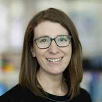 Jess Littlejohn is the Data Systems Manager at Ventia Utility Services and manages a team responsible for storage, auditing and dissemination of data across the Environmental Monitoring business. Jess holds a Bachelor of Environmental Science (Hons) and Master of Environment, specialising in water resource management. Jess has worked in the water industry for over 10 years in a number of roles including as Environment Officer for SRW, environmental consultant for Hydro Environmental, Halcrow and CH2M HILL and Water and Sanitation Officer for CARE International and Habitat for Humanity.
Jessica has knowledge and technical skills in marine and freshwater ecology, water resource planning, data management, water quality sampling, industrial water management, integrated water catchment management and environmental approvals within both Australian and International contexts.
Wednesday 1530: Technology: Discharge Rating Curve Development
Stuart Hamilton, Senior Hydrologist, Aquatic Informatics, BC Canada; and Ray Maynard, Supervising Hydrographer at DNRM Bundaberg, Qld.
Abstract
For any well-selected gauging location there is a unique relation between stage and discharge that is valid for a specified period of time. However, it is up to the stream hydrographer to discover the form of this relation, for a given episode of time, by a combination of stream gauging and inference-making.
The importance of inference in rating curve development cannot be over-stated. Even if given the same data it is unlikely that any 10 hydrographers would produce identical hydrographs, with the differences being primarily due to inferences made about curve form, extrapolation, and response to dynamic in-stream conditions. There are many factors that influence inference-making including: standards, training, techniques and technologies – all of which vary between monitoring jurisdictions.
All three countries use the same non-linear shifted power law rating equation, Q = a∙ (GH – z)m. In the main they also use log-log rating curve plots, although some areas in Australia use GH vs Q0.4 plots, and a small subset occasionally use the more flexible GH vs Q1/m plots.
The biggest rating difference is that a single height offset is used in Australia for each rating curve, presumably as a legacy of paper log-log plots. Canada and the US now use a unique segment-specific height offset for each pair of rating curve datapoints, which typically gives more flexible rating curves that can need less datapoints to span a given range.
The three parameters of a properly-fitted shifted power law rating equation convey meaningful information about the local site hydraulics, whereas those poorly fitted using a sub-optimal height offset are hydraulically meaningless, due to parameter interaction in the fitting process.
Another notable rating difference is the fairly general Australian use of families of discrete rating curves, whereas Canada and the US favour multiple base rating curves that are then modified by 3-point height shifts to account for subsequent small rating changes.
Rating extrapolation methods are fairly similar in all three countries. However, some areas in Australia tend to use the Σad½ method and less use its later derivative Σad2/3.
More use could be made in all three countries of prior rating information from cross section shapes and shape changes in the context of the influence of vegetation, particularly for over-bank flow. Stream channels in Australia are often of complex shape, although areas with regular high runoff tend towards simpler U-shaped channels similar to many streams in Canada and the USA.
Increased recognition that a unique rating is not possible at many sites is driving an increase in the number of deployments of ADVM in North America. ADVM usage is also likely to increase in Australia because of boat gauging safety concerns and because many remote sites are difficult to access during floods.
The similarities in approach affirm that fundamental principles are respected. Differences in approach are presented as an opportunity for improving international communication and collaboration on common problems.
Speaker bio
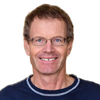 Stuart Hamilton: From 1978 to 1997 Stu was a stream hydrographer working out of the Whitehorse, Yukon Office of Water Survey of Canada where he developed a strong interest in the challenges of monitoring flow under ice conditions. After earning a M.Sc. in hydrology he moved to Vancouver, BC where he was Head, Hydrology Research and Development for Environment Canada until 2006, when he took on the role of Head, Operations Support for Water Survey of Canada. In 2009 he joined Aquatic Informatics as Senior Hydrologist. In this present role Stu has become fascinated with the similarities and differences in the practice of hydrometric monitoring around the world and, in particular, what we can learn from our differences.
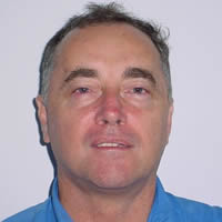 Ray Maynard started work in Mareeba on 20 February 1975, and just over a week later was helicopter-borne to a 22 day flood-gauging camp at Wenlock on Cape York Peninsula. Dry-season vehicle trips to remote areas were common, with one camping trip of 29 days averaging 10.6 hrs per day. When flood gauging the Russell River in 1977, one nearby station measured 4200 mm of rain in 3 weeks! Ray transferred to Bundaberg in August 1977. He subsequently gauged floods up to 9450 cumecs by boat and current meter, and up to 7329 cumecs by ADCP, with point velocities up to 6.57 m.s-1. In 2011 his ADCP Troubleshooting guide was included in a BOM ADCP Standard. He’s a voracious reader, and is passionate far past the point of obsession about meteorology, climate, fluvial hydraulics, hydrology, alternative medicine, and conspiracy theories (among others!)
Wednesday 1600: Technology: Ground Water Monitoring in Coal Seam Gas
Geordie Durack, Natural Resource Officer (Hydrogeology), Queensland Department of Natural Resources and Mines
Abstract
The Queensland Department of Natural Resources and Mines (DNRM) has recently implemented a new groundwater monitoring program in areas of Coal Seam Gas (CSG) development. There are two sub-projects: CSG Online and CSG Net.
The CSG Online program involves the installation of continuous monitoring loggers and telemetry on 60 strategically located bores, the data from which is made publically accessibly ‘live and online’. Where traditionally DNRM has installed telemetry equipped water level loggers in DNRM owned, dedicated monitoring bores, the CSG Online program is also utilising suitable private water bores as monitoring locations. The methodology for installing and maintaining telemetry equipped water level loggers alongside water supply pumps in private water bores has required innovation and some trial and error. However, the inclusion of private water bores as potential monitoring locations has greatly increased the spatial reach of the program. The water level data received from bores that are intermittently pumped for water supply can in some instances provide additional information for water resource analysis beyond that obtained by traditional dedicated monitoring bores.
CSG Net is a community based monitoring program where landholders in CSG areas are engaged in groups, provided with information on the CSG industry and groundwater systems and encouraged to measure groundwater levels in their private water bores on a monthly basis. Systems have been developed to enable landholders to submit their monitoring data to the department for storage in the department’s groundwater database, the data from which is publically accessible via the Queensland Globe. Outcomes from the landholder monitoring, and complementary monitoring undertaken by DNRM and CSG companies, are shared and discussed at annual workshops.
The new monitoring program has been highly successful to date. Similar programs are being actively considered for use in other sectors in Queensland where operational activities associated with industries such as mining or shale gas may impact on landholder’s access to groundwater resources.
Speaker bio
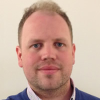 Geordie has worked in the field of groundwater assessment and planning in the Queensland state government for seven years. In this time he has been involved in significant groundwater resource allocation and management projects, including; monitoring groundwater level trends to inform annual resource allocations, overseeing hydrogeological assessments for the trade of existing entitlements and sale of unallocated water from the Great Artesian Basin, and providing input to Queensland’s involvement in the federal Murray Darling Basin Plan.
Currently he is part of the Coal Seam Gas Compliance Unit where he is responsible for the investigation and assessment of reported impacts to groundwater resources. This role includes the design, implementation and review of an independent groundwater level monitoring network to track impacts from Coal Seam Gas development and verify Coal Seam Gas company monitoring results.
Wednesday 1615: Technology: Acoustic Doppler Technology in Sediment Transport
Daniel Wagenaar, Senior Hydrologist, Sontek / Xylem USA
Abstract
The application of acoustic doppler instruments have expanded into various facets of catchment hydrology and water engineering and this paper will demonstrate the successful integration of the technology within catchment hydrology but also shows the significant improvement in existing practices and the development of more reliable techniques in determining:
- Suspended-sediment concentration;
- Bathymetry and Velocity Mapping;
The traditional methodology that was applied over the past century in defining these key parameters had number of limitations due to the available technology and resources required to perform field measurements and often resulted in insufficient and unreliable data sets for model development and yield calculations.
Research was done by the USGS and U.S. Army Corps of Engineers to identify the most effective surrogate for suspended-sediment concentration (SCS). The methodologies that were identified for the study consisted of turbidity, laser diffraction and acoustic backscatter principles. During the initial investigation it was found that the most promising technique is the measurement of acoustic backscatter strength with an acoustic doppler velocity meter (ADVM). A surrogate model was developed based on the SSC samples taken over a two year period in both the Clearwater and Snake Rivers from 2008 -2010. ADVM measurements were per-formed during the same period and the acoustic backscatter surrogate displayed the best relation with the measured SSC during the development of the model. The acoustic surrogate model provides improved estimation of SSC and load than the traditional sediment-transport curves based on discharge during different time scales when sediment concentration is variable (Wood and Teasdale 2013).
The technology available for bathymetric surveys is limited to the measurement of bed profiles and the incorporation of velocity and or river classification along the channel with bathymetry surveys information is a complex process. SonTek has developed HydroSurveyor software that is built on the current RiverSurveyor acoustic doppler current profiler (ADCP) platform that enable the user to perform depth measurements and velocity measurements simultaneously for bathymetry and velocity mapping. The ability to create a complete elevation grid of the surveyed area, i.e. a digital elevation model (DEM), based on ADCP bathymetry and Lidar topography and then combine this with a 3D velocity grid of the survey area over several flow conditions gives the user a numeric solution and graphical presentation of flow conditions in the river based on 3D velocity and depth. This data can then be used to improve hydrodynamic river models, identify changes in river flow conditions, improve velocity-index equations, etc. The graphical presentation of field measurements ex-tends the scope of application to wider scientific audience within catchment hydrology studies. An intensive depth and velocity study was conducted by Idaho Power Corporation (IPC) on the Snake River just below CJ Strike Hydroelectric Dam in February 2015 to understand the influences of different turbine combinations on a nearby velocity index gauging station and the results are included in this paper.
Speaker bio
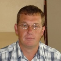 Daniel Wagenaar, a Senior Hydrologist at SonTek, Xylem. He received a B.Sc. in Water Engineering from Central University Technology and B.Sc. in Geohydrology from Free State University, South Africa. He has been involved in the hydrographic field for over 25 years. His past experience includes Technical Manager of hydrographic operations in South Africa and Manager of Water Monitoring Systems in Australia. His international experience includes development programs for Australian National Standards and design of Australian Hydrographic Diploma. His current focus at SonTek is the development of the methodology, quality assurance and data management used in collecting Acoustic Doppler data with respect to International Standards and Organizational requirements.
Wednesday 1645: Technology: Unmanned Aerial Vehicles in River Hydrography
Daniel Sinnott, Senior Hydrographer, WaterNSW
Abstract
Unmanned Aerial Vehicles (UAVs), also commonly called drones are a relatively low cost aerial sensing platform that allows a number of tasks to be performed at a much lower cost to conventional aerial methods or in such a way that potentially enhances or simplifies current methodologies used by field hydrographers.
UAVs take many forms and each configuration has inherent benefits and deficiencies related to their flight capabilities. In the field of river hydrography due to the topographies experienced, the ease of operation and the scale of areas being considered, an assessment of the available technology shows that the multi-copter configuration to be best suited to potential applications.
Potentials for UAV use include site mapping, 3D modelling of micro-catchments, remote installation inspection, safety applications in high risk work such as flood gauging, temporal recording of site condition such as vegetation cover and geomorphology, payload carrying, marketing , new site selection and site condition monitoring.
Certain limitations must be considered in UAV application, regulations controlling the use of private and commercial drones are about to be updated in Australia, with the aim to both enhance public safety and reduce red-tape, potentially making simplifying both private and commercial drone use.
Many other factors also need to be taken into consideration such as Occupational Health and Safety, privacy and no-fly zones outside of those in CASA regulations. Drone use must also take into account possible negative effects to native wildlife which may have their life-cycles disturbed through UAV interference.
Currently advanced remote sensing devices available for UAVs tend to be expensive, and there are technological limitations which can make it quite costly to enhance drone use with a selection of different camera types and other sensing equipment. With the current popularity of UAVs it is expected that this will change, with both commercially available affordable options, and with the growing popularity of amateur technology hacking making more sensing options available at a competitive price point. A practical test of deploying a UAV in the field was conducted using a DJI Phantom 3 quad-copter and an assortment of software applications tested to enable the mapping of an operational NSW site (Mann River at Jackadgery). Utilising android apps, a cloud-based system and a windows software application, field aerial photography was collected at the site which allowed the construction of orthorectified photogrammetry in high definition. This was further processed into a 3 dimensional map of the micro catchment and a digital elevation model constructed which could, with further work, serve as a reasonably accurate basis for establishing site cross sections, longitudinal sections and development of high-stage rating tables in a much more time-efficient manner than using current ground-based survey methods.
Speaker bio
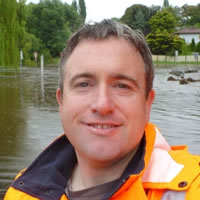 Daniel Sinnott began his hydrographic career in 2007 with the then Department of Natural Resources based in Tumut, NSW. Daniel cut his teeth in river hydrography on the upper Murray River catchment, first as an assistant, but very quickly stepping into a vacant position of supervising hydrographer before moving to Armidale NSW to join the Hydrometric Network Expansion (HNE) project. Under the federally funded HNE he contributed to the establishment of 88 new hydrometric gauging stations and telemeted groundwater bores across NSW. Currently he manages a network of gauging stations in the 203, 204 and 206 catchments out of the Armidale Office of Water NSW.
Prior to his Hydrometric work, Daniel studied Environmental Science through Charles Sturt University while working in environmental compliance and environmental management system auditing for GWM Water in western Victoria and preceding that, for Thales Australia.
Daniel also has extensive experience in the mining industry operating metallurgical extraction systems in 4 different states and was an industrial radiographer for Australian Defence Industries for five years, working in quality control of munitions.
Wednesday 1715: Technology: Removing tidal aliasing in estuarine discharge data
Justin Stockley, Xylem
Abstract
A major waterworks supplying water to Singapore in South Peninsula Malaysia draws its source water from the Johor River. During high tides in dry seasons, a salt water wedge pushes far enough upstream to affect water supply operations. In 1993 a dam was constructed such that upstream water could be regulated and selectively released to push back the salt water wedge.
In 2010 it was found that with the development of the surrounding area and subsequent increase in water consumption upstream of the waterworks, that the salt wedge was again impacting water works operations. This coincided with low dam levels due to a drier than expected monsoon. As such a study was commissioned to better understand the existing baseline flows along the major rivers with one expected outcome being to determine travel times of released dam water to the water works in order to optimise dam operations.
A series of three gauging stations were established along the river which measured water level and velocity. The peak discharge from the dam release was clearly tracked through the first two stations. The third station was affected by tidal flux and as such the movement of the peak discharge was effectively masked. This paper looks at the methods employed to collect the information as well as the subsequent analysis of the data to assist the operation of the dam and waterworks. In particular, the use of a low pass digital filter to remove tidal aliasing is demonstrated and a broader context comment on the handling of discharge data subjected to tidal influences is discussed referencing current USGS policy.
Speaker bio
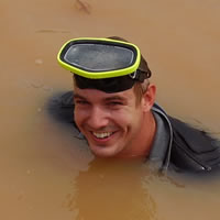 After completing my Environmental Science degree at the University of New South Wales a job advertisement promising abseiling down manholes caught my eye and I joined Sydney Water. The new millennium offered an opportunity in Singapore with Greenspan Technology Services where I was based for the next 12 years. I arrived in Perth in 2012 only to find the streets weren’t paved with gold and the price of iron ore had plummeted! I joined Water Corporation WA as Senior Hydrographer in 2015. Delivering water and wastewater services to the entire state meant I was involved with hydrographic work over a diverse range of environments; from Kununurra to Albany. With a lack of significant surface water to sate my hydrographic appetite I moved on from Water Corporation after a year and a half to join Xylem working on Surface Water business development in the ASEAN region.
Thursday, 27th October 2016
Thursday 0900: Applications: Out of Control: Satellite Based Differential Correction Service for Remote Area Bathymetric Data Collection
Peter Waugh, Manager Water Monitoring Systems, NT Department of Land Resource Management
Abstract
The Department of Environment and Natural Resources have developed integrated surface-groundwater models to better inform management decisions relating to water resource allocation.
Due to the remote nature of the Northern Territory and resultant site access issues, data available for the construction of these models is spatially sparse, resulting in significant interpolation of hydrological and hydrogeological features.
In order to increase resolution of the hydraulic gradient and better define the interface between surface and groundwater resources, a longitudinal survey was undertaken of the primary channel thalweg for both the Roper and Katherine-Daly Rivers.
Project objectives were to determine river bed height to an accuracy of +/-0.200 m AHD along the non-tidal length of both rivers.
With poor river access and no existing survey benchmarks along most of the survey area, conventional RTK Differential GNSS techniques using a base station over a known point were prohibitively expensive and time consuming, if at all possible.
Utilising a new satellite based differential correction service, a longitudinal section was completed for both rivers within a suitable timeframe and budget and without the need for establishing a dense network of ground control points.
This presentation will provide an overview of the technology, and the two different techniques that were used to undertake each survey.
Speaker Bio
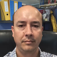 Peter Waugh is the Manager of Water Monitoring Systems for the Department of Environment and Natural Resources in the Northern Territory.
Previously, Peter has worked as a Hydrographer for the Northern Territory Government, a Hydrology Specialist at Melbourne Water and as an Associate Consultant for GWP Consultants (UK).
Peter holds a Bachelor Degree in Applied Science (Geomatics) from RMIT University (2000), and a Master of Water Resource Management from Melbourne University (2009).
Thursday 0930: Applications: Remote Monitoring and Alarming for Floods and Sewer Level Montoring
Paul Hart, Commercial Director, Metasphere Australia Pty Ltd
Abstract
Remote monitoring
On average 15 people die in Australia every year as a result of floods, 10 of these as a result of people attempting to drive through flood water.
Despite numerous ongoing public awareness campaigns to educate the community of the dangers of driving through floodwaters the number of fatalities continues to rise. Subsequently, proactive State Road agencies and Councils, including Queensland Transport and Main Roads (TMR) are turning to river level monitoring and alarming to provide highway flood inundation warning lead time allowing timely road closures.
QLD TMR are currently trialling such a system for their State Highway Network using Metasphere’s Point Orange battery powered Remote Telemetry Unit (RTU) combined with a water level sensor. The remoteness of many creek and river crossings along the State Highway Network make physical inspection of water levels and assessment of possible road inundation ineffective during flood events. Therefore, remote monitoring and alarming has huge potential to save time, money and health and safety risks of TMR staff as well as lives of drivers and passengers prevented from driving through the flood waters. This paper would further detail the benefits of this proactive monitoring approach, the technology adopted and why it was chosen.
When combined with Metasphere’s Bureau service, ‘Palette’, our online data visualisation and management platform, the remote monitoring combines to create an effective, near real time, decision making tool for agencies.
Functionality of the Point Orange RTU includes 3G enabled, IP68, up to 5 sensors, 5+ years battery life and Comms agnostic (DNP3 levels 2, 3 and parts of 4, Modbus, SDI-12, RS282, RS485).
Sewer Level Monitoring
Many Water Utilities have Key Performance Indicators (KPIs) around minimising the risk of sewer blockage and uncontrolled discharges, which can cause health hazards and disruption to the community.
Proactive water utilities are opting to monitor and manage their high risk blockage sites using a combination of Metasphere Point Colour range of battery powered Remote Telemetry Units (RTUs) and Pulsar dBi Ultrasonic Level Sensors. When combined with Metasphere’s Bureau service, ‘Palette’, an online data visualisation and management platform, they combine to create an effective, near real time, decision making tool for water utilities and government agencies.
Projects are underway with major water utilities in NSW, QLD and VIC using the above combination of technology. This paper would detail the benefits of this proactive monitoring approach, the technology adopted and why it was chosen.
Functionality of the Point Colour RTUs includes 3G enabled, IP68, IECEx, up to 5 sensors, 5+ years battery life and Comms agnostic (DNP3 levels 2, 3 and parts of 4, Modbus, SDI-12, RS282, RS485).
The Pulsar dBi Ultrasonic level sensors are the only sensors on the market specifically designed for sewer level monitoring applications, ranging from 0 to 15 meters they stand out for their superior echo recognition, narrow beam angle and low power – enabling longer battery life for the complete solution. With over 6000 dBi’s installed worldwide this non contacting solution is well proven.
Speaker bio
 Paul is a hydrologist and flood risk manager by background and has spent 17 years delivering high profile projects in Australia, UK, Netherlands, Vietnam and Malaysia including the recently updated Brisbane River Hydrology (following the 2010/11 floods) and Ho Chi Minh City Flood Management Strategy. Paul recently joined Metasphere as Commercial Director, responsible for growing the business across Australia and NZ. Paul has a degree in Physical Geography, Masters in Water Resources, is a Chartered Member of CIWEM (Institution of Water and Environmental Management) and is a committee member for Engineers Australia Sydney Water Panel. Paul is an experienced speaker having regularly presented at conferences such as ‘Floodplain Management Australia’, ‘International Rivers Symposium’ and ‘Naturally Hazardous Queensland’.
Thursday 1000: Applications: Means to an End in Data Collection
Glenn McDermott, Principal Consuiltant, Enviromon
Abstract
The old saying is “the end justifies the means” by Machiavelli in the 16th century. In the hydrometric business the “end” has in the past been to provide accurate flow and level and other data, with certified and experienced hydrographers, following national standards and/or best practice methods as “the means”. With the advent and increasing use of SCADA telemetry systems, users and clients are more and more requiring the availability of this data real-time, to make operational decisions. At first this was only at sites where some operational control could be exercised by the operator. In several large water authorities, however, this thinking is being extended to include all monitoring sites, including those used for long term planning and reporting- with strong questioning of the need for continuing such non-operational sites. This is now leading to questioning of the frequency of site visits and the cost of accurate calibration checks. These business reviews go hand in hand with budget cuts. So what is basically the “means” of collecting data (ie real time telemetry) is now becoming “the end” in questioning the accuracy maintenance practices and costs of the hydrometric industry. In effect there is a growing risk that future hydrometric work will be done by electricians and not hydrographers. This paper presents the history of this issue as observed in Sydney Water and the NSW Department of Primary Industries. Its primary purpose is to raise the issue, with the hope that a way of working together can be found which benefits both the hydrometric industry and the electrical engineering industry (ie SCADA aspects), going forward.
Speaker bio
 Graduating in 1978 from the University of NSW, and spending the past 38 years since then on assorted major and minor projects involving hydrology, hydraulics and/or hydrometric monitoring. The initial 13 years of this were with Sydney Water Corporation, while the latter 25 have been with private industry or other government departments. Some of the major projects he has contributed project management and/or specialist monitoring and modelling advice to (as part of a project team) have been:- AR&R guidelines; Sydney’s Ocean Outfalls; Warragamba Dam spillway amplification ; Sydney’s urban flood management taskforce; Sydney Clean waterways programme and overflow licensing programme; NSW river water allocation IQQM modelling and planning for re-allocation; Singapore stormwater harvesting project; Malaysian Smart Tunnel project; New computer modelling system for Sydney Water water distribution system planning; Sydney’s Wet weather Sewerfix Alliance programme; Flow data accuracy assessments for the irrigation industry in NSW and Victoria; Singapore University stormwater monitoring weir and flume designs; Use HECRAS modelling for various clients requiring theoretical rating tables (eg for environmental flow reporting at mine sites); Develop flood forecasting model logic for downstream Wivenhoe Dam; Write and deliver AHA and Sydney Water hydraulics modules; and, Perform rain gauge network rationalisation review for Sydney Water.
Thursday 1100: Applications: Application of Hydrographic Data
Todd Lovell, Data Operations Manager, Bureau of Meteorology
Abstract
The Bureau of Meteorology (the Bureau) is responsible for the compiling and disseminating comprehensive water information across Australia. The Bureau collects data from approximately 200 organisations with more than 10,000 raw files received per day from organisation named in the Water Regulations. This data is stored, collated and managed in the Bureau systems and is used to produce the following water information products and systems including:
- The Australian Water Information System (AWRIS)
- Water Data Online
- The National Water Account
- Seasonal Streamflow Forecasts
- Hydrological Reference Stations
- Ground Water Explorer
- Rainfall Intensity, Frequency and Duration
- National Water Markets System
- Water Restrictions
- The National Geofabric
This paper will investigate use of hydrometric data at the national level and explore the publication of the data though value added products and data utilisation by stakeholders. One example that will be discussed is how water managers and key water users are using seasonal stream flow forecasts to improve their water management and decision making capability.
Speaker bio
 Todd Lovell works for the Bureau of Meteorology (the Bureau) heading up the team responsible for the collection of water data from approximately 200 organisations named in the water regulations, and ingesting that data into the Australian Water Information System (AWRIS). Todd is passionate about collecting and collating water data and making it available online to all Australians through the AWRIS system, the Water Data Online website and the many different products produced by the Bureau and other water management organisations.
Todd holds a Bachelor of Information Technology and previously worked as a Hydrographer with Sydney Water. He has over 25 years’ experience in the collection, management and publication of water data.
Thursday 1130: Applications: National Standards for Flood Warning
Carla Mooney, Project Manager, National Flood Warning Infrastructure Working Group, Bureauof Meteorology
Abstract
The National Flood Warning Infrastructure Working Group has been set up under the auspices of the ANZEMC with a very specific mandate to develop national technical standards and risk based infrastructure plans. Chaired by the Bureau of Meteorology and Co-Chaired by the Attorney-General’s Department, the Working Group will bring considerable focus onto the issues of flood warning infrastructure over the next 3 years. The Working Group is made up of senior officers from the Emergency Service Agencies and relevant Water Authority from each State and Territory. It is supported by two Technical Advisory Groups.
The adequacy of infrastructure to collect and communicate accurate near real time data required for forecasting floods and preparing warnings was identified as an issue by the Munro Review and the Hazards Services Taskforce.
The Munro Review was established following the protracted severe weather in the summer of 2010-11 where floods were experienced in many parts of Australia. It looked at the Bureau’s capacity to respond to extreme weather events. It identified a number of issues including the variations in hazard services across the States and Northern Territory and the lack of clarity about roles and responsibilities for flood management. The Standardisation of Bureau of Meteorology Hazards Services Taskforce was established by the ANZEMC in October 2013 to respond to the key recommendations of the Munro Review. The Taskforce identified seven critical issues including the lack of consistency in flood data collection networks, the absence of standards for instrumentation and data communication technologies, and sustainable funding which were compromising the sustainability of flood monitoring networks.
The Infrastructure Working Group will undertake two separate but complementary tasks. It will develop a set of national performance based standards for flood warning infrastructure, outlining a tiered approach to ensure standards are fit-for-purpose and compatible with the level of flood risk being addressed. The second major task is to develop a risk based National Strategic Flood Warning Infrastructure Plan based on individual jurisdictional plans. The National Plan will outline the functionality and condition assessment of existing flood warning infrastructure and clearly define the priorities, strategies and actions to address the gaps in current flood warning infrastructure and knowledge.
This paper will report on progress with defining the scope and interim functional requirements for the Flood Warning Infrastructure Standards. It will also outline the approach being used to develop the flood warning infrastructure plans and the challenges of harmonising the methods used across the different States and Territories. The benefits of national collaboration on this important issue will be highlighted.
Speaker bio
 Dr Carla Mooney was recently appointed as the Project Manager for the National Flood Warning Infrastructure Project. Carla has worked at the Bureau of Meteorology for 5 years and was previously the Stakeholder Engagement Manager, Water Accounting and Regulations. Carla was a Research Fellow at Griffith University for three years prior to joining the Bureau. She has 20 years’ experience in water planning and stakeholder engagement. Carla holds a PhD in Law from the University of Wollongong, a Masters in Natural Resources Law (UOW) and a Masters in Environmental Planning (Macq.Uni).
Thursday 1200: Applications: Innovation in Compliance Monitoring
Daniel Condon, Operations Director, HydroTerra
Abstract
Keywords:
Environmental monitoring, Compliance reporting, DataStream.
Background/Objectives.
Compliance monitoring forms a major component of environmental monitoring in Australia. Strong regulatory and licencing structures in most states underpin the need for the activity. The costs to industry of compliance are recurring and often costly. Traditional compliance has involved a component of sampling, manual field measurement, some automated telemetered data provision and reporting. With the rapid changes in monitoring technologies (sensors, telemetry and data management packages) the traditional approaches are in many cases no longer best practice, efficient or cost effective.
Inefficiencies in compliance monitoring are common as monitoring requirements tend to grow iteratively and there is seldom the time to assess the overall costs of compliance monitoring and to look at more efficient ways to achieve the desired outcome.
HydroTerra has developed a systematic approach to assessing compliance monitoring requirements and providing optimised monitoring solutions. This requires understanding of regulatory requirements, measurement technologies and their accuracy and maintenance/calibration and installation requirements. A cost benefit analysis is required to look at choices of measurement and reporting methodologies. This approach has been applied at many sites. The systematic methodology used is outlined in this paper.
Four case studies are presented:
- landfill compliance monitoring (integrated system across 11 landfills in Victoria);
- Baseline wetland characterisation in Bellarine Peninsula in Victoria involving flow and water quality characterisation,
- Environmental discharge monitoring and automated control measurements for brine discharge to open channel network in South Australia, involving pipe, open channel and estuary monitoring approaches.
- Coal seam gas automated groundwater compliance monitoring network of 120 monitoring wells in Surat Basin, Queensland.
This paper highlights the opportunities and challenges facing hydrographers in the future. Measurement technology changes, requiring a diversity of skills for effective implementation. The need to understand the regulatory requirements, monitoring and telemetry instrumentation, IT and a range of software platforms, is critical to developing a sound cost effective measurement approach. The ability to assess the benefits of traditional and emerging technologies and how they can be integrated is essential to providing industry with efficient measurement in the future.
Speaker bio
 Daniel is an Environmental Scientist who has had five years’ experience working within the Environmental Sector. Daniel has had a great deal of experience managing and completing a number of sampling and monitoring programs at several sites across Victoria, New South Wales, South Australia and Western Australia. As Hydroterra’s Operations Manager, Daniel is responsible for building strong relationships between HydroTerra and clients who are interested in utilising HydroTerra’s skilled sampling and instrumentation technicians.
Thursday 1315: Implementation of National Environmental Monitoring Standards in NZ (NZHS conference best paper winner)
Elizabeth Fox, Water Resources Scientist, Opus, NZ
Abstract
There has been a significant change in the number and type of end-users utilising environmental data, shifting from primarily scientists and analysts to a wider demographic. With an increase in available environmental data on the web has resulted in the need for a clear, easily understood format describing what the data means, and if it is fit for intended purpose. In contrast to Australia, New Zealand’s environmental monitoring industry had disparate standards on how to collect, process, and archive data. Environmental data from different agencies became difficult to collate and analyse, nor gave an indication to the end-user on its accuracy or reliability for analysis. This led to the creation of the National Environmental Monitoring Standards (NEMS) in 2009. With compounding problems for the end-user New Zealand has opted to move away from a national, centralised archive in favour of federating individual collection agencies’ archives; forcing the need for quality control and standardisation across all environmental data collection agencies, enabling simplified product development for end-users.
NEMS provides nationally consistent procedures on how to collect, process, archive and assign Quality Codes to environmental data. Implementation of Quality Codes enables end users to utilise and review data that is comparable across multiple organisations. The Quality Code schema within NEMS gives important information regarding the reliability and accuracy of the collected environmental data, helping to determine what data is fit for specific purposes. At present, regional and unitary councils across New Zealand are implementing NEMS. Challenges have arisen adopting the new ways of collecting, processing, quality assuring and archiving environmental data, which are apparent when changing from individual organisation’s standards to NEMS; making sure the end-user understands how this transition impacts the data for their intended purposes is vital. Overall, the implications of adopting NEMS will bring large benefits to managing, sharing and utilizing environmental data within New Zealand, particularly in servicing the growing number, and increasing variety, of end-users nationally and globally.
Speaker bio
 I currently work as a Catchment Data Analyst in the Catchment Data Delivery team at Horizons Regional Council (HRC). I have been working within this team since May 2012 while completing my studies at Massey University. I have a BSc (Hons) in Physical Geography and a minor in Ecology, and have recently submitted my MSc in Physical Geography. In my current role, I am responsible for the processing and archiving of the environmental data that our team collects from over 100 sites across our region. This includes continuous water level, flow, water temperature, rainfall, groundwater and water quality parameter data. My work also includes assisting in the field with low flow and flood gaugings, general site inspections and assisting with the State of Environment monthly sampling. I thoroughly enjoy working with environmental data and contributing to the growing knowledge of environmental monitoring.
Thursday 1345: Lysimeters for Ground Water Recharge
Brent Hutchby, Environmental Data Officer, Bay of Plenty Regional Council, NZ
Abstract
The Bay of Plenty region was named on account of its abundant food resources and this continues to holds true today. The region is a key producer of kiwifruit and avocados, has significant forestry resources and a pulp paper mill, and as well as general cropping and farming it supports an intensive dairy industry. Thus there is significant demand for fresh water and increasingly groundwater.
With the aim of better understanding groundwater recharge across the region, the Bay of Plenty Regional Council has installed a monitoring network of barrel lysimeters. After more than a decade in deployment and recent expansion of this network, I will discuss the issues involved in the installation and collection of data as well as giving a broad overview of the network and results achieved.
Bio
 Brent Hutchby has been employed as an Environmental Data Officer with the Bay of Plenty Regional Council since 2008. His work largely involves field hydrology and monitoring of surface water and groundwater, as well as a range of general environmental monitoring. Brent has been involved in the Bay of Plenty Regional Councils groundwater lysimeter programme and expansion for several years and has gained experience in the installation and data collection from barrel lysimeters. Brent studied Geography and Archaeology at the University of Otago, NZ.

