Tuesday, 13 November 2018
KEYNOTE: The Impact of Extreme Events
Peter Heweston, Kisters, ACT
Abstract
Extreme events are difficult to quantify, and even more difficult to remember for long. Natural systems are extremely variable, and interact with human society in complex ways. We can learn much from the past as we face the future, certain only that there are probably unpleasant surprises in store.
Speaker bio
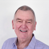
Peter Heweston was first exposed to the water business while working for CSIRO back in 1969. In the mid-80s he started his own company developing the water software HYDSYS, which later became Hydstra. In 2006 the company became part of the KISTERS group. Peter has worked in dozens of countries around the world over a long career, and continues to work on Hydstra to this day.
Peter has been presenting at KISTERS User Group meetings since 1992, and at innumerable conferences and training courses.
Extreme events: Before
Before: What is an Extreme Event?
Ray Boyton—Semi retired, NSW (and John Hayes—GAF AG, NSW)
Abstract
This conference is about dealing with extreme events.
Well from a hydrographic perspective (surface water (stream and storage), groundwater, meteorological) what is an extreme event?
- What other perspectives do we as a profession need to consider?
- Is it magnitude, duration, frequency, political, social, hydrographic workload or some combination of these or is there some other criteria?
- How do we recognise an extreme event?
- Is this something we can know in advance or is it only something that we can only judge after the event.
- How do other agencies in Australia and overseas define extreme events
Speaker bio
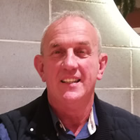
Ray Boyton has over 40 years experience in hydrography and the management of Hydrometric data and information within NSW Government agencies.
Entering the workforce almost straight from High School and without any Hydrometric skills he started as a Hydrographic Assistant in Tumut (Southern NSW) in July 1974 just months before the largest floods on record for many of the Murray-Darling rivers. Over the next 15 years he gained in depth knowledge of Southern NSW river and their gauging stations occupying a number of Hydrographic positions in Tumut, Parramatta and Muswellbrook.
In the early 1990s, when water information collection and archiving was being rapidly transitioned from a paper based to electronic medium he moved into the data and database management area, eventually rising to the position of Director Water Information within DPI Water at his retirement in 2015.
For 8 months during mid 2000s Ray was fortunate to be able to be part of the team that installed a national water database in Vietnam.
While semi retired he is available for contract work in Australia and Internationally.
KEYNOTE: Climate and Water Outlook
Robyn Duell, Bureau of Meteorology, Vic
Abstract
Join Robyn for an update of the Bureau of Meteorology’s outlook for rainfall, temperature and streamflow conditions for the coming months, with a focus on the likelihood of extreme weather events, such as heatwaves, drought, floods, tropical cyclones and bushfires.
Robyn will also include a wrap-up of recent conditions and talk through what is driving the outlook (e.g. the current state of El Niño, La Niña and the Indian Ocean Dipole).
Speaker bio
Robyn Duell is a senior climatologist in the Long-Range Forecast Services team at the Bureau. Robyn is the team’s lead in ensuring services are meeting customer needs – and hence she has played a key role in the delivery and development of climate services for Government, industry and the Australian community. Most recently this has involved leading the stakeholder engagement for implementation of an improved seasonal forecast service – including introducing a new high definition climate outlook model and forecasts for new timescales.
Robyn has a strong passion for connecting everyday Australians with complex science – finding new ways to interpret and make climate science understandable, usable and accessible for all.
Robyn grew up in country Victoria before completing a Bachelor of Science (Honours) in Atmospheric Science at Monash University in 2002, and a Gradate Diploma in Meteorology at the Bureau of Meteorology in 2003. Robyn worked as a weather forecaster for both the Bureau of Meteorology in Darwin and for the UK Met Office in Exeter, England, before joining the Bureau’s climate services team in Melbourne in 2008.
.
Before: The value of consistent hydrometric monitoring practices
Kema Ranatunga—Bureau of Meteorology, ACT
Abstract
Keywords: water information, hydrometric monitoring, flood warning, National Industry Guidelines, Flood Warning Infrastructure Standards.
The Bureau of Meteorology promotes standardised practices in hydrometric monitoring across Australia, in collaboration with organisations that collect water information. Standardisation provides significant benefits, i.e., efficient integration of data from diverse sources, improved interoperability, interpretation and understanding of water information, better assessment of the fitness‑for‑purpose of the data, and reduced duplication in effort by monitoring agencies to develop practices and procedures.
Two areas where a nationally provided service relies heavily on data from diverse sources are in protecting the community through flood forecasting and warning, and in assembling consistent and transparent national water information under the Commonwealth Water Act functions. In both these areas, the Bureau is promoting standardisation for data networks through the National Industry Guidelines for hydrometric monitoring (NIGLs) and through the Flood Warning Infrastructure Standard (FWIS – currently in draft), respectively.
First published by the Bureau in 2013, the NIGLs present recommended Australian industry practice for monitoring of surface water level and discharge, groundwater level, water quality and rainfall monitoring. The guidelines have been implemented by nearly all major water monitoring organisations involved in the collection, analysis and reporting of hydrometric information. Organisations recognise the role of these non-mandatory guidelines in reducing exposure to risk associated with the development and maintenance of monitoring programs, and providing clear, high-level guidance and targets to mitigate under performance of monitoring networks. The Water Monitoring Standardisation Technical Committee (WaMSTeC) is currently leading a 5-year review of the guidelines, to ensure they remain up-to-date with technological advancements, and to expand on the guidance relating to groundwater site establishment and monitoring.
Concurrently, the Bureau is leading development of FWIS as part of a series of standardisation activities being advanced by the Australia-New Zealand Emergency Management Committee (ANZEMC). The FWIS focuses on flood warning infrastructure from field instruments and communications equipment, through to data ingestion for receiving, storing and displaying real time flood data. It will address the key issues of fit-for-purpose development of flood warning infrastructure, and the need for national consistency and coordination for risk based investment in these networks. Non-mandatory and performance based, the FWIS will be published in March 2019 following extensive public and industry consultation.
Those responsible for hydrometric monitoring need to be aware of both the NIGLs and the upcoming FWIS, and understand how to bring them into practice. The paper will outline the relationship between the standards and discuss the areas of commonality and differences. It will also explore some practical issues of implementing these standards, and how together they will help achieve the goals of consistent practices and interoperable data.
Speaker bio
 Kema has been working with the Bureau of Meteorology since 2008 in Water Regulations and standards. Before joining the Bureau, Kema was with the Department of Agriculture and Water Resources working on integrated water sciences. He also worked at National de la Recherche Agronomique (INRA) in France, and the International Water Management Institute in Sri Lanka. He graduated in Agricultural Engineering from University of Peradeniya in Sri Lanka, completed a Master of Engineering at Asian Institute of Technology in Thailand and obtained PhD in Biophysical Modelling at La Trobe University in Melbourne. His research interests include water regulations and data, standards and surface and groundwater modelling.
Before: Call that an extreme event? Describing the extremeness of an event before, during and after the event
Janice Green—Bureau of Meteorology, ACT
Abstract
After large rainfall and flood events, news reports often make statement such as:
“Train commuters hit with cancellations as ‘one-in-100-year’ storm clean-up continues“
“Tennant Creek deluged with ‘one-in-50-year’ flood“
“Severe weather warnings issued as a once in 50-year storm barrels towards the nations southeast“
But what does it mean? How extreme are these events and how often do they occur?
Being able to define how extreme an event will be; is currently being experienced; or was, is vital information to assist in preparing for extreme events.
There have been some recent changes in the probability terminology that is used to define how extreme an event is. This is being done to ensure that everyone is clear about what the terminology means and are consistently used in messaging/communications from the Bureau to a range of stakeholders.
This new terminology emphasises that there is an equal probability of an event of a specified magnitude occurring or being exceeded in any given year, and that the probability of an event is independent of what has happened in recent years. The use of Average Recurrence Interval (ARI) as in ‘1 in 100 year event’ is now discouraged as it leads to confusion by suggesting an elapsed time between each event, whereas in reality a “100-year flood” can happen in successive years.
The Intensity-Frequency-Duration (IFD) design rainfall suite, updated and expanded by the Bureau of Meteorology in 2016, has adopted the new probability terminology to assist users. These are a useful way of defining extreme events and can be used to identify possible events in forecast data before they happen. The new IFDs are now being used internally within the Bureau to estimate the probability of observed and forecast rainfall events and to identify the potential risk of flooding in order to guide emergency management preparedness and response. They are also being used after events to assign a probability to the event and to assist in reviewing the emergency management plans for events of different extremities.
The presentation will demonstrate how the Bureau of Meteorology has used this information for recent large rainfall and flood events.
Speaker bio

Janice Green is the Manager of the Water Accounting and Regulations Section at the Bureau of Meteorology with responsibilities for the annual publication of the National Water Account and administration of the Water Regulations. She has 30 years’ experience in hydrology, hydraulics, and water resource management and has worked in the public sector, at both state and federal levels, and also in private industry.
Janice’s main area of expertise is in in the estimation of design rainfalls and floods and she has undertaken numerous flood studies and published widely on her work. She was responsible for the Bureau’s derivation of new design rainfalls across Australia as part of the 2016 edition of Australian Rainfall and Runoff.
Before: Improving the Network – SunWater’s preparedness for future weather events
Jason Venables—SunWater Limited, Qld
Abstract
SunWater is a bulk water infrastructure developer and manager playing a key role in Australia’s water industry, owning and managing around $13 billion in water infrastructure assets and supplying approximately 40% of all water used commercially in Queensland.
As these assets are spread as far north as Mareeba, west to Mount Isa and to the south St George and Goondiwindi, they are frequently exposed to extreme weather events such as very high rainfall and tropical cyclones (TC). Two such events in the past 3 years were TC Marcia in 2015 and TC Debbie in 2017.
SunWater is responsible for 23 Emergency Action Plans (EAP) in the event of spillway releases from all referable dams. When an EAP is activated, relevant stakeholders such as Queensland Emergency Services, local councils and immediate downstream residences are notified.
For the past 2 years, SunWater has been actively improving its preparedness for future extreme weather events by:
- Established an Operations Centre, manned 365 days per year
- Increased gauging station and rain gauge network
- Improved time series data flow
- Improved hydrology modelling tools, and
- Installation of remote cameras at all dams
These improvements rely on SunWater’s hydrographic sites and data network from 23 dams, 32 weirs, 52 streams gauging stations as well as several stand-alone rain gauges.
In this paper I will discuss further detail on such things as how this improvement program came about, the site selection process for new sites, improvements is time series data flow and how some of these improvements were used during a real-time event.
Speaker bio
Jason started in Hydrography as a trainee with Snowy Mountains Authority (SMA) in 1990, then in 1994 he became full-time, based in Jindabyne. During this time, he gained experience in various skills including strip chart recorder maintenance, gauging techniques, rating development, snow surveying, water level/weather station instrumentation installations as well as Hydsys, now Hydstra, data base management
Jason left SMA in 2000, spending 3 months skiing in Canada before moving the London. After pouring beers at pubs, he started working with Hydro-logic in Bromyard, England and resigned from SMA. This role included numerous water level and quality installations around England and Wales, such as Birmingham International Airport and Heathrow T3 project.
Jason successfully applied for a Senior Hydrographers position back with SMA and moved back to Jindabyne in September 2001. In 2004, he became the Hydrographic Services Manager before leaving in Apr 2014 to be the Senior Hydrographer with SunWater based in Brisbane. At the time he left Snowy Hydro, he managed Snowy Hydro’s hydrographic team of 10 and the Cloud Seeding field team of 3.
During his short time with SunWater, he has overseen more than 50 improvement projects across Queensland; including the implementation of Hydstra, installation of remote cameras, 12 new or relocated gauging stations, 20+ new rain gauges as well as utilising drones for rating reviews.
Before: South East Queensland ALERT2 Trial – Increased reliability and accuracy of flood warning data
Stewart Neilsen—SEQwater, Qld and Mike Zucosky—OneRain Incorporated, CO USA
Abstract
For over 30 years, ERRTS, also known as ALERT, has provided a ubiquitous real-time monitoring standard radio protocol for hydrologic data transmissions. ALERT has proved invaluable but has limitations; especially during extreme events. ALERT2, the next generation protocol for weather data transmission, has been designed to solve these reliability issues. We present the results of the first deployment in Australia of existing ERRTS gauging sites leveraging end-to-end the ALERT2 protocol, with quantitative comparisons of ERRTS and ALERT2 transmission performance.
Speaker bio
Stewart graduated from the University of Queensland in 2005 with a Bachelor of Environmental Management (Natural Systems and Wildlife).
From 2006 to 2009 he worked for the Department of Natural Resources, based in Emerald in central Queensland, working on a project to investigate the effects of different farming management practices on runoff (quantity and quality) to the Great Barrier Reef.
Since 2009 he worked for SEQwater, based in Ipswich. During this time he has been responsible for maintaining an extensive network of water resources and flood warning infrastructure, and ensuring the collection and dissemination of up to date and accurate data.
Mike holds an M.B.A./Master of Business Administration from Colorado State University, Colorado, USA and a B.S./Electrical Engineering from Case Western Reserve University, Ohio, USA
As General Manager at OneRain Incorporated, Mike brings valuable experience in Program and Project Management. For over a decade, Mike has managed implementation, installation and maintenance operations of automated flood early warning and environmental monitoring systems for many government municipalities and districts across the USA to ensure high-quality operational hydrologic gauge data for functionality and public safety. He directs the development and deployment of mission-critical data collection, visualization and dissemination software and guides the development, testing and implementation of real-time data collection systems for high accuracy meteorological and hydrological gauging stations. In conjunction with SEQ Water, he helped deploy the first end-to-end ALERT2 gauge system in Australia.
Before: An evaluation of real-time water measurement
Dejan Subaric—Department of Natural Resources, Mines and Energy , Qld
Abstract
DNRME operate and maintain a network of more than four hundred primary stream or surface water gauging sites around the state of Queensland. These sites are telemetered and as such are expected to provide 24/7 access to water monitoring data.
During extreme events the reliability of our network can be compromised due to telemetry outages. In order to address this and provide timely, reliable and accurate data the team at the Hydrographic Support Unit (HSU) have carried out several development activities. This work has been underpinned with internal modernisation and external communications network changes.
To improve rate of change measurements, HSU has undertaken a bench and field evaluation of several commercially available continuous bubblers, which are summarised in this paper.
Pivotel is shutting down the Queensland Globalstar gateway in June 2019. To avoid losing telemetry data at satellite coverage pluviograph sites, we successfully evaluated and deployed a new satellite telemetry instrument.
During Cyclone Debbie in 2017 a significant portion of DNRME monitoring network was cut off partially due to infrastructure damage within the Telstra mobile network. In light of this network failure a decision was made to challenge the market to provide a robust, turnkey redundant telemetry platform. This work has resulted in the largest monitoring network change for Queensland in fifteen years.
Speaker bio
 Dejan has worked in the instrumentation and calibration field for over eight years and started working as a systems officer for the Department of Natural Resources, Mines and Energy within the Queensland Government in 2018.
His role at the Hydrographic Support Unit (HSU) for Queensland hydrography accounts for leadership and development in innovative new technologies for the state’s monitoring data.
He holds a Bachelor’s Degree in Microelectronic Engineering (Communication Systems).
Before: Modelling Rating Curves on the Fitzroy River
Lauren Greening—Department of Water and Environmental Regulation, WA
Abstract
Flow ratings are being developed at remote streamflow gauging stations in Western Australia using 1D and 2D hydraulic models. This is in place of traditional extrapolation techniques and in the absence of measured streamflows.
The Fitzroy River is a unique example due to the extreme variability in flow, very large flows, meandering channels and moving bed. It is important to define a repeatable flow rating with a known sensitivity at gauging stations on the Fitzroy River to inform water resource development, including interests in groundwater surface water interaction, potential future water use and cultural and environmental importance of the river. Climate change in the north west of Australia is not well understood, however the likelihood of more extreme events is probable. Discharge measurements and peak surface water profiles collected during an extreme flow event can then be targeted for model calibration and validation. The modelling software can also be used as a design tool prior to the installation of future streamflow gauging stations.
Speaker bio
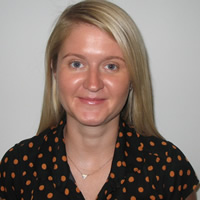
Lauren works as a surface water hydrologist at the Department of Water and Environmental Regulation for the Government of Western Australia. She has 10 years’ experience working in surface water hydrology since completing a Bachelor of Environmental Engineering, with honours, at the University of Melbourne. Lauren’s work focuses on hydraulic and hydrologic modelling as a tool to inform water resource management. This has included:
- modelling self-supply irrigation catchments in south west WA to inform allocation and licensing decisions
- modelling design flood events to inform development within floodplains
- modelling streamflow gauging station reaches to improve the quality and confidence in streamflow data.
Before: Flood Impact on Monitoring Instruments
Matt Saunders—Unidata, WA
Abstract
Flood affects many things including monitoring and measuring instruments and associated telemetry systems.
This paper outlines planning for monitoring instruments before during and after flood events and outlines the need to consider many factors when a flood event.
This paper overviews the experience of the Royal Irrigation Department (RID) of Thailand during major flood events where monitoring instrument operation is critical and where some equipment worked and some equipment failed and why.
The paper then outlines design considerations to reduce the vulnerability of some installations considerations of different installations.
Speaker bio
 Matt Saunders is the General Manager of Unidata Pty Ltd ( A NIWA Company), a long established environmental monitoring and industrial measurement equipment and software manufacturer.
Matt Saunders has telecommunications engineering qualifications and more than 25 years of senior management experience in the communications industry. This experience includes software development, research and development electronics design project management and manufacturing.
Matt has been an active senior member of the Institute of Radio & Electronics Engineers (IREE) and the IREE Communications Society. (IREE COM SOC) for more than 25 years.
Before: Stormwater Pond Surveying: Why probe when you can ping
Jennifer Leslie—Pattle Delamore Partners Ltd, NZ
Abstract
A new method of bathymetric surveying of stormwater ponds is saving time, increasing data quality and reducing health and safety risks for field staff. It involves driving a remote controlled Q-boat around stormwater ponds with an Acoustic Doppler Current Profiler (ADCP) and collecting accurate bathymetric and position data, which can be used for multiple purposes.
Auckland Council manages nearly 500 stormwater ponds across the Auckland region, so maintenance works do present a significant cost. To provide a means to prioritise pond maintenance, Pattle Delamore Partners (PDP) and Auckland Council are using this new methodology to calculate sediment accumulation volumes, comparing the ADCP results to as-built drawings of when the pond was built or last maintained. This information is useful to determine whether the stormwater pond is functioning efficiently, whether dredging maintenance is required, and where greatest sedimentation is occurring within the pond. The data can also provide an indication of dredging costs based on the sediment volume that requires removal.
There are numerous advantages that the Q-boat and ADCP methodology has over the traditional manual probe surveying method including: faster data collection; greater data accuracy; and reduced health and safety risks. In addition, comparative evidence between the two methods suggests that the manual probe surveying method may actually be compromising the integrity of the pond.
In this paper, the field techniques used to collect ADCP data and the post field data processing techniques will be explained, and the potential uses of data outputs explored. The benefits and shortfalls of this method compared to the manual probe surveying method will also be discussed with examples given. Case studies of other projects where the methodology has been applied will also be looked at; these include a bathymetric survey of an estuary and a marine port area.
Speaker bio
 Jennifer Leslie is an Environmental Scientist within the Surface Water and Environmental Management team at Pattle Delamore Partners (PDP) in New Zealand. She has a Postgraduate Diploma in Science in Environmental Science from the University of Auckland and a Bachelor of Science in Geography from the University of Otago. Jennifer has been involved in a broad range of projects during her time at PDP in the areas of stormwater, freshwater quality/quantity, ecology and contaminated land.
Wednesday, 14 November 2018
Industry Technical Workshops:
Jarrah Watson—eagle.io, Qld
Speaker bio
 Jarrah is a data scientist at the forefront of designing scalable software solutions to tackle environmental problems.
He is Co-founder & CTO of the remote monitoring cloud software platform eagle.io.
Jarrah has 15 years of international experience in architecting, building and managing mission-critical monitoring and control systems.
Industry Technical Workshops:
Paul Sheahan – Kisters, ACT
Speaker bio
 Paul is Assistant General Manager, involved in management and marketing issues within the Australasian KISTERS group. He recently returned to Kisters after a decade with the Bureau of Meteorology, having previously worked for KISTERS Pty Ltd and its predecessor company Hydstra Pty Ltd from 2001 through to 2008. He has had extensive experience in all aspects of the water industry and has a deep understanding of water data issues.
Industry Technical Workshops:
Paul Hart – Metasphere, NSW
Speaker bio
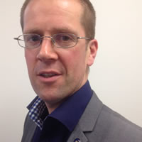 Paul is a hydrologist and flood risk manager by background and has spent 17 years delivering high profile projects in Australia, UK, Netherlands, Vietnam and Malaysia including the recently updated Brisbane River Hydrology (following the 2010/11 floods) and Ho Chi Minh City Flood Management Strategy.
Paul recently joined Metasphere as Commercial Director, responsible for growing the business across Australia and NZ.
Paul has a degree in Physical Geography, Masters in Water Resources, is a Chartered Member of CIWEM (Institution of Water and Environmental Management) and is a committee member for Engineers Australia Sydney Water Panel. Paul is an experienced speaker having regularly presented at conferences such as ‘Floodplain Management Australia’, ‘International Rivers Symposium’ and ‘Naturally Hazardous Queensland’.
Industry Technical Workshops:
Matt Saunders – Unidata, WA
Speaker bio
 Matt Saunders is the General Manager of Unidata Pty Ltd ( A NIWA Company), a long established environmental monitoring and industrial measurement equipment and software manufacturer.
Matt Saunders has telecommunications engineering qualifications and more than 25 years of senior management experience in the communications industry. This experience includes software development, research and development electronics design project management and manufacturing.
Matt has been an active senior member of the Institute of Radio & Electronics Engineers (IREE) and the IREE Communications Society. (IREE COM SOC) for more than 25 years.
Industry Technical Workshops: CO2 flux monitoring for a Carbon Capture and Storage project in the Precipice Sandstones
Paul Jensen—ALS Hydrographics, Qld
Abstract
This project combines water, soil and air quality monitoring in continuous near real time. We are using a number of innovative monitoring techniques that will help identify if a material leak has occurred. This includes the use of Eddie Covariance flux monitoring, CO2 monitoring drones, vegetation mapping, pH measurements in overlying aquifers and continuous soil gas readings. This project I believes shows the versatility of Hydrography skill set for applications to a wide variety of Environmental monitoring.
Speaker bio
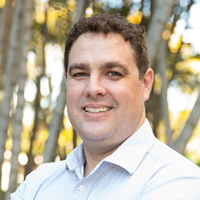 Paul is an environmental monitoring professional with 15 years of experience providing effective solutions for clients across government, mining, construction and research industries.
Industry Technical Workshops: Maximize Acoustic Doppler Accuracy during Extreme Events with Hydrographic Principles
Daniel Wagenaar—SonTek / Xylem, NSW
Abstract
The FlowTracker® Handheld ADV is an Acoustic Doppler Velocimeter (ADV®) that is designed to perform accurate point velocity measurements in flowing water. The FlowTracker offers ADV performance from a simple handheld interface, allowing rapid data collection without the use of a computer.
The FlowTracker2 was launched in 2016 with a number of hardware and software improvements. The most noticeable hardware changes were the handheld and the ADV stem. The new handheld offers color graphics and real-time data display, and the probe assembly can be detached from the handheld.
The electronics of the ADV were moved from the handheld to the ADV itself, resulting in a slightly larger stem. This change reduces the instrument noise and allows the interchange between probes and handhelds. The FlowTracker2 Tow Tank Verification technical note gives an overview of the test facilities, reference instrumentation, test methodology, results and requirements of Tow Tanks. The verification process focused on two main aspects: Velocity Accuracy and Flow Disturbance.
Speaker bio
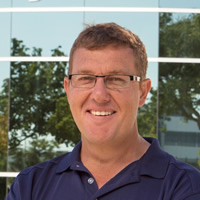 Daniel started his hydrographic career in South Africa as hydrographer with experience in surface water and ground water monitoring. He continued with his career progression as Technical Manager of hydrographic operations overseeing all computations including rating development and data processing. He expanded his 29 years’ experience in hydrographic operations by accepting Manager of Water Monitoring Systems position in Australia, responsible for the design of business process frame works and the development of operational standards, quality assurance systems and training. His focus at SonTek consist of the development of Acoustic Doppler measuring techniques, enhancement of surface water methodology, quality assurance and data management principles used in collection of Acoustic Doppler data. The assessment of latest research, International Standards and Organizational requirements forms a key component in the development and enhancement of measuring techniques. Daniel holds a B.Sc. in Water Engineering from Central University Technology and B.Sc. in Geohydrology from Free State University.
Industry Technical Workshops: Bridging the data management gap in Africa
Stuart Hamilton—Aquatic Informatics, BC Canada
Abstract
Water is widely recognized as being a key driver for improving prosperity and health throughout the African continent. However, patterns in African climate, geography and land-use often results in too much, too little, or of the wrong quality of water to support sustainable development goals. Consequently, foreign assistance for economic development is frequently supported by funding for water monitoring activities resulting in many decades of water monitoring throughout Africa.
Whereas the benefits of these investments in water monitoring should be apparent in improved water governance, policies and planning, there are too few examples of tangible successes. Inadequate investments in data management can be attributed as a fundamental cause of a disconnect between data and decisions. Experience gained from several African agencies that have recently upgraded to a modern data management system is examined in light of the problems that can be solved when water data are life-cycle managed to be fully fit-for-purpose.
Effective data management is a universal requirement for successfully linking water monitoring to beneficial watershed-scale outcomes. Lessons learned from Sudan, Rwanda, Tanzania and Zambia illustrate several fundamental principles of water data management that any water monitoring agency can benefit from.
Legacy data—i.e., data we expect to be providing an essential understanding of basic hydrology and also of the cumulative effects of land-use and climate change—often requires expensive rescue from diverse, insecure, sources. Once rescued, data lack metadata essential for investigation of provenance. Large gaps can exist in the data and hydrographs can reveal episodes of time where the reported values are highly suspect thereby degrading confidence that any of the data are trustworthy. Such data problems are often hidden behind a firewall making all data inaccessible except to the most persistent investigators.
Data neglect typically results from a simple lack of awareness of the importance of data management. For example, distrust due to non-delivery of data makes budget cuts easier, unshared data results in incomplete stakeholder engagement; and a lack of oversight of the state of the data results in an unhealthy reliance on ‘business as usual’. It is not uncommon for water monitoring programs to degenerate to a dysfunctional state for lack of effective data management.
An alternative path is one where water data is valued and protected as a national asset. Best practices are followed for monitoring design; confidence is restored with data quality assurance; efficient workflows ensure timely and appropriate information; expertise is harnessed to create timely and useful knowledge products; and the needs of a wide range of decision-makers are addressed.
Managing the present, and preparation for the future, will require adoption of the principles and best practices for managing water information as a strategic investment. This paper highlights monitoring as a strategic asset and draws on experiences gained in the implementation of modern hydrometric data management systems in Africa.
Speaker bio
Stream Hydrographer for Water Survey of Canada, Whitehorse Yukon, from 1978 to 1997 gauging remote sub-Arctic streams with special attention to measurement and estimation of flow under ice.
Head, Hydrology Research and Development for Environment Canada, Vancouver BC, from 1997 to 2006, with emphasis on hydrological, hydraulic and water quality modelling, decision support systems, and the development of Canada’s first real-time hydrometric data portal.
Head, Operations Support for Water Survey of Canada from 2006 to 2009 focussing on purchases of monitoring equipment, major capital asset management, Occupational Safety and Health, client relations, human resources and financial management.
Senior Hydrologist Aquatic Informatics 2009 to present assisting with research, design, development, quality assurance, support, training, marketing, and client relations with a particular interest in identifying, explaining and promoting best practices for hydrometric monitoring within a global context.
Keynote: Drought and the importance of accurate and reliable water monitoring data
Ashley Webb, Manager Water Monitoring, WaterNSW
Abstract
WaterNSW is the bulk water supplier, river operator and one-stop-shop for most water licensing, water trades and water information in NSW. It supplies two-thirds of the bulk water used in NSW from its 42 dams, and from rivers and pipelines to regional towns, irrigators, Sydney Water and local water utilities. WaterNSW has integrated its hydrometric, water quality and groundwater monitoring functions. It owns and operates the largest surface and groundwater monitoring network in the Southern Hemisphere. Accurate and reliable water monitoring data are critical to the needs of WaterNSW’s business, as well as to its customers.
Australia’s climate is highly variable and many factors and activities can impact on the quality and quantity of water available in surface and groundwater systems. This poses challenges for the reliable supply of quality water, both urban and rural. Long-term water monitoring datasets underpin planning decisions regarding the size and operation of various systems, detailing the extremes ranging from flood characteristics through to baseflow conditions during severe droughts. At the time of writing (August 2018) all of NSW is either drought-affected, in drought, or in severe drought. In the northern two-thirds of the state, with the exception of the north coast, serious to severe rainfall deficiencies are evident. For the 16 months from April 2017 to July 2018 some areas of the northern inland and the southeast coast of NSW registered the lowest rainfall on record. This is placing pressure on surface and groundwater resources, with well below record-low inflows to a number of storages.
Water monitoring data become crucial in the management of water resources under these conditions as rainfall-runoff, water balance and river basin models require timely, accurate and reliable input data to enable estimation of system inflows, required water delivery volumes, timing and associated losses. Water monitoring data inform critical system decisions and provide real-time validation of model predictions to ensure the most efficient use of valuable water resources. Furthermore, accurate measurement of very low flows is essential for the implementation of water sharing plans in NSW, especially in identifying when ‘cease to pump’ conditions apply. Droughts remind us that the monitoring networks we design and operate need to be fit for purpose. Climatic conditions, catchment characteristics and land uses can change over time, as can the demands of water- and data-users. A challenge for water monitoring teams is to foresee these changes and ensure that our water monitoring networks, data collection techniques and management systems keep pace and continue to meet the data requirements of next-users and end-users. In the context of WaterNSW, this means meeting the current and future water data needs of modellers, analysts, planners, regulators, system operators and ultimately, our customers.
Speaker bio

Ashley Webb is Manager Water Monitoring at WaterNSW with responsibility for the operation and maintenance of the organisation’s integrated surface water, groundwater and water quality monitoring networks. He has >20 years of experience in hydrology, water monitoring, land and water management. Ashley has honours degrees in Science (UNSW) and Law (UNE) with a PhD in Science (Sydney). He was previously employed by the Forestry Corporation of NSW for 12 years, firstly as a soil and water specialist then as Water Monitoring Manager. For the 5 years to mid-2018 Ashley was a leader and manager of teams with NSW DPI Agriculture delivering applied projects and programs in partnership with industry R&D corporations. He has contributed to inter-agency committees on water quality, water information standards, plantation water use, and primary industries research, development and extension. Ashley is based in Tamworth and leads a team of ~100 water monitoring staff located throughout NSW.
During: Innovative high flow measurement systems: Recent Case Studies in Tajikistan and Canada
Mike Lysaght—HyQuest Solutions, NSW
Abstract
Tajikistan:
Background: An in-situ stream discharge measurement system was required on the Vakhsh River for measurement of discharge from the Rogun Hydroelectric Project. A permanent solution to sense, estimate, log and report stream discharge data in close to real time was required.
System Design / Innovation: A new cableway to allow deployment and retrieval of ‘non-contact’ sensing system for discharge estimation. Remote location of site, safe access, risk mitigation for installation and commissioning phases were the main considerations.
Installation/ Commissioning Phase: Civil works required, safety, local labour requirement, specialised equipment, survey, manual ADCP measurements & telemetry.
Operational Phase: Flood event data capture rate, data uptime, site calibration, system performance during extreme events
Outcomes: Reliable continuous sensing and reporting of stream discharge. Likely duplication of the technology at more sites.
Canada:
Background: A ‘turn-key’ solution for deployment of ADCPs as a direct result of Water Survey Canada ‘condemning’ the use of manned cableways. Requirement was for an easy to install and operate solution for comparatively short spans of approximately 100 m.
System Design / Innovation: Water Survey sought an engineered system utilising ‘modular’ posts” to cater for varying height requirements with manual device to position the ADCP across the stream. Remote location of site, safe access, risk mitigation for installation and commissioning phases were the main considerations.
Installation/ Commissioning Phase: Civil works required, safety, local labour requirement, specialised equipment, survey, manual ADCP measurements, telemetry
Operational Phase: Flood event data capture rate, data uptime, site calibration, system performance during extreme events
Outcomes: An easy to erect and operate system to facilitate safe measurement of high flows rates using ADCP technology.
Speaker bio
 Mike commenced his role with the company in 2006 and brings over 40 years of experience in field hydrology. He holds the Hydrography Certificate with other qualifications in Electrical Principles, Digital Computing, Process Fluid Measurement and Industrial Instrumentation Practice. As a qualified and certified hydrographer he has also prepared and delivered a wide range of training topics in the area of field hydrology to the water industry world-wide.
During: the importance of hydrological data during extreme events.
Mark Wolf—Emalte, NSW
Abstract
I will address the approach being taken for new and existing dams, cities and towns globally.
Included will be examples of hydrological equipment being installed, short video of integrated systems being used in Indonesia.
Included will be new modelling techniques used for forecasting extreme events and their integration with:
- hydrological instrumentation and associated data logging and telemetry equipment
- cloud and enterprise data acquisition systems –
- electronic warning systems (dam break, flash flood, tsunami, etc.)
I will use the practical example of how real time hydrological data is being used to protect the City of Kuala Lumpur during extreme events and how that data is used to adjust the flow of stormwater into the City and store in the KL SMART Tunnel and how the real time data is used continuously to manage the stormwater.
Speaker bio
Mark Wolf has been working on water related investigations and projects since 1979. Initially with the NSW Public Works (17 years), then to Principal Consultant of Greenspan Technology and Prospect Environmental (20 years) to now CEO of EMALTE.
Mark and his various Teams of Experts have delivered more than 1000 projects in 26 nations with many noteworthy accomplishments including:
- World’s Best International Project – awarded by the British Construction Industry for the Kuala Lumpur SMART Tunnel – Mark and his Team at Greenspan designed the Flood Detection and Stormwater Management component of the project
- Design and delivery of multiple Flood Early Warning Systems complete with SCADA, Warning Stations, Catchment Monitoring and Modelling
- Delivery of the National Data Acquisition System in partnership with Aquatic Informatics for Water Survey Canada
Mark is currently focusing on delivering projects and developing new business with his hand- picked team of experts.
During: Before, During and After Hurricane Harvey: Performance of an ALERT2 Flood Warning System during a Category 4 Hurricane
Gavin Hewitt—Campbell Scientific, Qld
Abstract
Harris County, Texas, USA, is home to over four million people and is the third most populous county in the U.S. On August 25, 2017 those four million residents were watching the approach of the first major hurricane since 1970 to make a direct hit on the southern Texas coastline. Hurricane Harvey made landfall as a Category 4 storm with 130 mph (209 km/h) winds, heavy rains, and a massive storm surge. The hurricane was quickly downgraded as it made landfall and by August 26 it was considered a tropical storm with winds below 50 mph (80 km/h). However, as the hurricane lost strength it also stalled over Harris County. From August 26-30 the storm dropped massive amounts of rainfall on Harris County, producing catastrophic flash and river flooding. Hurricane Harvey set new records for peak intensity and average intensity over the duration of the storm.
The average annual rainfall for Harris County, TX is 49.77 in (1.264 m). The goal of the Harris County Flood Warning System (FWS) is to provide accurate, real-time rainfall and stage data to facilitate crucial decision making before, during, and after flood events. The Harris County FWS relies on 139 gauging stations placed throughout the county bayous and connected tributaries of 22 watersheds.
During Hurricane Harvey, every watershed in the Harris County Flood Control District’s (HCFCD) jurisdiction experienced at least a 100-year rain event, and some areas exceeded the 20,000-year rainfall frequency. An average of 33.7 inches (0.86 m) fell across the entirety of Harris County, inundating the region with more than one trillion gallons of water—enough to keep Niagara Falls flowing for more than a week. Flooding was catastrophic, and Hurricane Harvey became the flood of record for many channels, with nearly 70,000 structures damaged by flooding.
The following paper will go into detail on the legacy ALERT network and the 2015 upgrade by HCFCD to ALERT2. Including details on the measurement hardware and communication network. We will also discuss how the new ALERT2 network preformed during Hurricane Harvey and the maintenance that was required after the storm.
Speaker bio
 Gavin Hewitt joined Campbell Scientific Australia in February 2010 as a key application engineer specialising in hydrology and water quality monitoring. Working on many key data acquisition projects over the years, it is his specialist knowledge in understanding the measurement requirements of these industries that has allowed him to provide systems that are reliable and provide the best data possible for each application. Moving into a Sales and Support Management role in 2016, Gavin is also responsible for organising and delivering training courses and materials to train internal staff and customers on how to get the most out of their data. From system development to troubleshooting live installations, Gavin’s knowledge and expertise in the hydrological, water quality and coastal sciences provide customers with better access and support to their critical data.
During: A New Solution for realtime flood intelligence in NSW
Bronson McPherson—Manly Hydraulics Laboratory, NSW
Abstract
MHL FIT is a tool designed to help flood managers and emergency responders make decisions about flood events as they develop. It incorporates real-time and predicted data from a range of sources and provides interactive inundation and timing data in a web-based format in near real-time. Users are able to account for uncertainty by using built in what-if scenario tools and see results immediately. The tool is developed in conjunction with councils and the SES to provide the most important and useful information required for decision making.
Flood prediction in Intermittently Closed and Open Lakes and Lagoons (ICOLLs) is complicated by the highly variable downstream conditions which are constituted by tidal behaviour, berm height, entrance dynamics and morphology, ocean waves, and differing management policies for Lagoon entrances. The timing of opening entrances can also have a significant impact on the peak flood level and must take into consideration not only tidal cycle but also the degree of scour an entrance may be subject to. These factors all impact on the actual peak height during a flood event.
A case study will be presented of the Manly and Narrabeen Flood Intelligence Tool which integrates these considerations and provide a means to perform on-the-fly sensitivity and scenario testing to ensure informed decisions are made in an emergency. Additionally, it also incorporates forecast tidal and BoM rainfall predictions into its automated predictions.
Having a single informational source which is maintained in the long term also helps to reduce Council’s reliance on individuals and assists with continuity of flood information.
Speaker bio
 Bronson is the Director of Engineering at MHL with over 20 years experience in water engineering specialising in flood-related projects, hydrologic and hydraulic modelling and software development. Bronson has extensive experience in numerical, conceptual and physical modelling of hydrological and hydraulic processes as well as environmental data analysis, collection and reporting.
During: Space Time Image Velocimetry: Measuring High Flow Events in Queensland
Mark Randall—Department of Natural Resources, Mines and Energy , Qld
Abstract
Collecting data during high flow events presents a number of challenges to hydrographers. Having to deal with measurement site access, staff numbers, and of course workplace health and safety requirements can mean that many high flow events pass unmeasured. As concerns about climate change grow so does the focus on “Extreme Flow Events” and the need to measure these events.
Since 2016 the Queensland Government, Department of Natural Resources, Mines, and Energy (DNRME) has been trialling the use of image velocimetry to measure high flows. Image Velocimetry is a non-intrusive measurement technique that measures surface velocities from a short video collected via an onsite IP camera or a drone. This is a method gaining increasing interest around the world as monitoring agencies try to solve the same problems associated with high flow events.
DNRME is now considered one of the lead agencies in the world for implementing Space Time Image Velocimetry providing training/information workshops in the USA, and later this year in Iceland and the UK.
Speaker bio
 Mark has been working as a field hydrologist with the Queensland State government since 2006. Based in Mareeba he specialises in remote area field operations and the management of the state governments gauging station network. He has run advanced ADCP training for QLD government hydrographers, Established national ADCP technical reference group, produced three national guidelines governing the use of hydroacoustic instrumentation for discharge measurements now endorsed and published by the Australian Bureau of Meteorology. In 2014 he worked with Teledyne RD Instruments to help develop Q-view software to provide QA/QC analysis of ADCP discharge measurements based on the matrix developed for the national guidelines.
Mark is currently an active member of the WaMSTeC and its predecessor, the Water Information Standards Business Forum established by the BoM in 2010. He is continuing to advance the use of acoustic Dopplers within water monitoring and is currently working on an ADCP training package.
During: Flood Warning Services in the Korokoro Stream Catchment
Ethan Coulston—Greater Wellington Regional Council, NZ
Abstract
The study of floods and the provision of flood warning is an integral part of our role in the Greater Wellington Regional Council’s Hydrology team
In December of 2016 Greater Wellington Regional council were requested by The New Zealand Transport agency (NZTA) to provide flood warning services in the Korokoro Stream catchment which is located within Wellington, New Zealand. Flood warning services were required due to the Korokoro Stream being susceptible to inundating the nearby state highway, causing road closures. Two major floods for example occurred in 1976 and 2015.
As a newly employed Environmental monitoring officer with 6 months of experience, this project was given to me so I could learn many of the core aspects of field hydrology in a single project- thrown in the deep end if you will!
The presentation will consist of all the aspects of this project (planning, execution, analysis, reflection etc) and encompasses all the fundamentals of surface water hydrology.
Speaker bio
 Ethan Coulston, from Masterton, New Zealand, grew up on a farm in the rural Wairarapa and so always enjoyed the great outdoors and natural environment. This passion carried through to his later years where he completed a Batchelor of science at Massey University in Palmerston North, New Zealand. Upon completing the degree he was given the opportunity to work on a summer river flow study with the Greater Wellington Regional Council. From there and for the past year he has been in the role of Environmental Monitoring officer within the Hydrology team where he has been given many challenging projects and am continuing to learn every day.
During: Maximize Acoustic Doppler Accuracy during Extreme Events with Hydrographic Principles
Daniel Wagenaar—SonTek / Xylem, NSW
Abstract
The accuracy of Acoustic Doppler measurements are directly related to site selection, measurement principles and user operation. Site Selection Requirements for the application of Acoustic Doppler instruments are based on a number of measurement site and hydraulic requirements. The requirements are very similar to what a Hydrologists or Hydrographer will use in the selection of monitoring site in either natural or artificial channels.
Acoustic Doppler Principles and standard operating procedures are essential during the data collection and post processing process. The application of principles and well documented processes will ensure consistent and quality data sets that are measurable. Most organizations have well documented standard operational procedures that align with International Standards to ensure that the application of the methodology is consistent.
Obtaining the required knowledge and skill set to perform, interpret and analyze Acoustic Doppler measurements requires considerable exposure time to field application and data review process. Acoustic Doppler Instruments, depending on the sensors used supply a large amount information for the operator to interpret and analyze in real-time and post processing.
The application of Acoustic Doppler instruments in flow measurement process requires sufficient knowledge on Acoustic Doppler principles, hydraulic theory, channel and catchment characteristics, especially during extreme events.
The measurement site and hydraulic conditions at the measurement section should be assessed before and during the measurement. It is imperative that the operator has a good understanding of possible impacts on Acoustic Doppler measurements and how it could affect the overall measurement accuracy.
The review and analysis of Acoustic Doppler data during Post Processing can be complex, especially if external references such as Compass, GPS and CTD data are used. Multiple tier review was developed to assist operators with analyzing and processing of Acoustic Doppler data collected. The first tier consists of “Initial Review” of the various references collected and associated data from external sensors. The “Initial Review” should be performed in the field to determine if the measurement quality and if additional data is required.
The second tier consists of “Detailed Review” should be performed in the office. The “Detailed Review” process brakes down the evaluation to an individual sample. Extrapolation and other processing techniques are performed during this stage to determine a final quality score.
The multiple tier review process outcome is based on the operator knowledge and understanding off all the facets discussed. Automated review process such as QRev (USGS) is highly recommended, especially during complex flow measurements such as Extreme Events. The automated review process also gives consistent approach in how the data is analyzed and processed between operators and different hydrographic offices.
Speaker bio
 Daniel started his hydrographic career in South Africa as hydrographer with experience in surface water and ground water monitoring. He continued with his career progression as Technical Manager of hydrographic operations overseeing all computations including rating development and data processing. He expanded his 29 years’ experience in hydrographic operations by accepting Manager of Water Monitoring Systems position in Australia, responsible for the design of business process frame works and the development of operational standards, quality assurance systems and training. His focus at SonTek consist of the development of Acoustic Doppler measuring techniques, enhancement of surface water methodology, quality assurance and data management principles used in collection of Acoustic Doppler data. The assessment of latest research, International Standards and Organizational requirements forms a key component in the development and enhancement of measuring techniques. Daniel holds a B.Sc. in Water Engineering from Central University Technology and B.Sc. in Geohydrology from Free State University.
During: Suspended sediment & turbidity monitoring in NZ – a product of Extreme events!
Evan Baddock—National Institute of Water and Atmospheric Research Limited, NZ
Abstract
This presentation overviews some important things to know about suspended sediment and turbidity monitoring in New Zealand rivers.
In New Zealand it is common to use turbidity to derive suspended sediment concentrations. However, estimating suspended sediment loads from continuous turbidity measurements is complicated by numerous factors including; stream flow changes, type and positioning of sensors, sediment flux, and biological fouling and debris causing false readings (to name a few). There is an increasing ‘confusion’ on how to best conduct the monitoring, instrument validation procedures, and in particular how to use the data for various purposes.
Continuous turbidity monitoring is becoming more frequently used in our networks around the country for a variety of purposes, ranging from use as a proxy variable to determine suspended sediment concentrations through to using it as an absolute value for environmental state assessment. While New Zealand has developed a turbidity ‘National Environmental Monitoring Standard’ (NEMS), this does not seem to cover or satisfy all use cases and challenges encountered when measuring turbidity.
Obtaining consistent and robust relationships between turbidity and suspended sediment are particularly challenging and this presentation will illustrate some of those challenges, what we have learnt from them, and possibly raise some questions for discussion.
Speaker bio
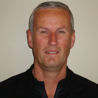
Hydrologist & Field Team QA Manager- National Institute of Water and Atmospheric Research, Dunedin based for the last 30 years.
BSc at Otago University, Post Graduate Groundwater Diploma, NZ Diploma in Field Hydrology.
Duties include: Maintaining the Data Archive, which involves hydrometric, climate and water quality data collection. Use of Hydro-acoustic equipment for river flow gauging. Extensive use of computers to translate, interpret and archive data using Aquarius software. The management of projects, from budget control, installations, to field data collection and presentation. QA Manager for Field Teams, involving site and office visits to maintain NIWA’s ISO standards, manual updates and general QA issues needing resolved or implemented. Training course preparation and teaching along with e-learning video training production.
Capabilities: Water quality sampling, bed material sampling, RTK surveying, suspended sediment and turbidity sampling and monitoring, telemetry system installation and management, “real-time” data dissemination, software development and maintenance, climate monitoring, discharge measurements using the latest ADCP techniques in all river environments, instrument installation and maintenance, alpine snow station work, light construction, instream habitat assessment, Shellfish surveys, and Resource Consent work. Teaching/training and use of video tools for e-learning purposes.
During: The growing demand and difficulties of hydrometric measurement of extreme events in urban stormwater and sewers
Justin Stockley—Xylem Analytical, WA
Abstract
Measurement of water level and discharge in urban stormwater and sewers during intense rainfall events presents many challenges for the hydrographer. Faced with fast peak response times, complex flow conditions, interactions with groundwater and surface water bodies as well as safety issues, there has been demands on technique and technology to enable the collection of accurate data.
The functional design criteria of stormwater drains and sewer networks now incorporates allowances for climate change in many countries. With aging infrastructure, sea level change and more intense rainfall events, there is a growing demand for accurate measurement methods as well as active monitoring systems that can notify relevant emergency services in real time.
This paper looks firstly at the impact of climate change on the hydraulic operation of storm and sewer systems, drawing on case studies to highlight the increasing demand for accurate data. The difficulties faced by the hydrographer when measuring data during peak events is also addressed as well as the typical technologies employed. Finally, hydrometric data collection in cities is faced with operational demands which drive real time decision making and responses to extreme events. Case studies are provided along with emerging technologies that are enabling data collection and transmission.
Speaker bio
 After completing an Environmental Science degree at the University of New South Wales a job advertisement promising abseiling down manholes caught Justin’s eye and he joined Sydney Water. The new millennium offered an opportunity in Singapore with Greenspan Technology Services where he was based for the next 12 years. He arrived in Perth in 2012 and shortly thereafter joined Water Corporation WA as Senior Hydrographer in 2015. Delivering water and wastewater services to the entire state meant he was involved with hydrographic work over a diverse range of environments; from Kununurra to Albany. With a lack of significant surface water to sate his hydrographic appetite he moved on from Water Corporation after a year and a half to join Xylem working on Surface Water business development in the ASEAN and North Asia region.
After: Using all the tools in your toolbox
Phil Downes—Environment Canterbury, NZ
Abstract
History: Environment Canterbury runs a network of 160 water level/flow recorders throughout the region these are represented by three main types of rivers; Alpine Rivers, Foothill Rivers and Springfed Streams.
The Selwyn River is a typical foothills river that flows across the Canterbury Plains to the south of Christchurch and the river where this presentation will concentrate on.
The Selwyn River has three water level recorders along its reach, Selwyn River @ Coes Ford is at the lower end of the catchment and the site that is of most interest for both low flow and flood analysis.
The site commenced in 1954 and records show significant events where the stage exceeded 8m in 1994, 2000, 2002, 2008 and 2017 note the stopbank is at 8.5 m. Gaugings were done during the 1994, 2002 and the 2017 events the first two 5 km downstream due to technology available at the time.
The results from the first two gaugings were transferred up to the recorder site using a velocity/area relationship. During this period our flood hazard engineers developed a flood model for the river, which was different from our extrapolated flow. We had many discussions about the difference but no resolution.
At the 2017 event we had new technology (ADCP and jetboat and ADCP and QBoat) that gave the opportunity to measure these higher flows and determine the flow when the river was bank full.
Conclusions: The results from our physical measurements and the estimate from the flood model both agreed within the uncertainties of both measurement. The learnings for me was that we should use all the tools in your toolbox to better determine/verify results.
The presentation will outline the calculations and extrapolations to obtain our initial flow and then the physical gaugings and the resulting changes and reasons why we got it so wrong initially.
Speaker bio
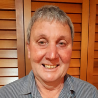 Phil is currently employed at Environment Canterbury as a Principal Science Technician.
He manages the Environment Canterbury surface water hydrology network which comprises of 155 water level/flow sites, 82 rainfall sites and 6 water quality sites measuring multiple parameters in a challenging environment.
The flood rainfall network system is situated on the main divide of the South Island at an altitude of about 1600 with an annual rainfall of 5000 mm and Alpine River systems that have time of travel of about 8 – 12 hours makes response times to get good flood information difficult. In addition to the flood network there is a network of compliance sites to monitor water takes. Currently this network consists of 1500 low flow gauging sites that are correlated to primary flow sites.
He has been with Environment Canterbury for over 30 years with the last 25 years in hydrology and experienced some significant changes in technology in this field.
The greatest changes include the measurement and recording of data and the new processing packages that are available, all of these making hydrology data more robust. The one thing we should not loose site of is that all this new technology still relies on the first principals of hydrology and hydraulics.
After: The cost of unseen extreme anomalies and the link between coastal and upstream systems
Sam Maddox—Manly Hydraulics Laboratory, NSW
Abstract
On the morning of 22 August 2017 Tweed Shire Council discovered that the Bray Park weir had been overtopped with salt water and the drinking water supply contaminated. Immediate shutdown of pumps and conventional water supply to the area occurred as salinity levels were now higher than the Australian Drinking Water aesthetic limit. Council was taken by surprise as the predicted tide should not have over-topped the weir. How did this tidal anomaly occur? Although this was a spring cycle in the tidal phase for the region [a forecast high of 1.790 m (TRHD)] there was no significant forecast wave action accompanying the high tides and no foreseeable cause for Council to enable their weir topping prevention protocol. Bray Park sits approximately 30 km up stream of the Tweed River entrance, so an oceanic anomaly would need to be of significant energy to reach that far upstream. What has caused this overtopping? Through analysis on tide gauges ranging from southern Western Australia to the Tweed entrance gauge a possible explanation is the phenomena known as coastal trapped waves (CTWs).
Southern hemisphere CTWs form by a synoptic disturbance and propagate along the coastline as free-standing waves. A system moving along the Western Australian and South Australian coast has generated a wave that has propagated and bent around the eastern coast under idyllic conditions, creating a tidal anomaly that has travelled up the NSW coastline and affected surrounding estuarine systems. The anomaly was measured at a height greater than 0.4 m above predicted water levels consistently across Manly Hydraulic Laboratory’s NSW ocean tide gauge network and in a distinct phase to indicate its northbound trajectory. Through analysis of MHL’s river and flood gauge network, which covers every major NSW river system, it was also possible to measure propagation of the CTW into estuarine areas and upstream river systems. With several gauges on the Tweed River we look to identify the anomalies movement up to Bray Park weir along with the calculated energy associated with the wave.
The overall negative effects experienced after this unseen extreme event has prompted Tweed Shire Council to look towards evolving their weir management procedure to incorporate coastal data. MHL is now looking to use available data with in-house modelling techniques to create a more complete warning system for the Council.
Speaker bio
 Sam is a Project Officer at MHL who is currently directing several hydrometric projects within the business ranging from flood warning networks in surrounding areas to NSW wide ocean tide monitoring program. Sam has experience in the collection, analysis, interpretation and reporting of environmental data along with an in depth understanding of hydrometric station setup and construction. He has worked on a variety of hydrometric projects over his 5 years of experience at MHL, the Office of Environment and Heritage, Water NSW (formerly NSW Office of Water, and Sydney Catchment Authority) and Water Savers Sydney water metering monitoring.
After: The right message, to the right person, in the right way, at the right time: Review of Greater Wellington Regional Councils Flood Warning Service
Nick Boyens—Greater Wellington Regional Council, NZ
Abstract
Greater Wellington Regional Councils flood warning service had over time become fractured and involved disparate agencies that were not always working as a cohesive unit. This resulted in potential risks that flood warnings may not be delivered effectively and the consequences of that could be severe. This combined with the recent developments in technology and the general thought that we could do better gave impetus to a full review of the Flood Warning Service. The review involved going back to our stakeholders and asking them how we are doing and what they expect to be getting from us. Information gained from this process was evaluated and resulted in an overarching service level statement of: The right message, to the right person, in the right way, at the right time. The project then engaged the expertise of the Risk and Society Department at GNS Science to help develop a picture of what the system should look like when aligned to current best practice and developing trends. The review process has been very valuable in that is has allowed council to re-engage with stakeholders, develop an aspiration for delivering a state of the art service, and garner support from senior management. A plan for implementing the recommendations of the review has been developed and has been successfully funded in Council’s long term planning process.
Speaker bio
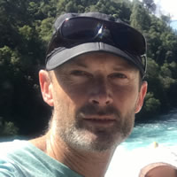 Nick is Team Leader for the Hydrology Team at Greater Wellington Regional Council. The team is responsible for the collection and quality assurance of hydrometric data from a network of around 250 sites (http://graphs.gw.govt.nz/).
Nick has been in the Team Leader role for 5 years but has come from a field hydrology background having worked as an Environmental Monitoring Officer at Greater Wellington since 2004. Prior to this he worked as a Technical Officer in the School of Earth Sciences at Victoria University of Wellington for 4 years having studied there and achieving a Master of Science degree. His studies included all aspects of Physical Geography with his postgraduate studies focusing on hydrology and fluvial geomorphology. Throughout his career he has had a strong interest in the technical side of the environmental monitoring discipline and in particular enjoy the opportunity to get out and get his feet wet and hands dirty.
After: Extreme events push data quality assurance to the limits – the experience of Cyclone Debbie
Sarah-Kate Dakin—Manly Hydraulics Laboratory, NSW
Abstract
In March 2017, tropical cyclone Debbie brought widespread rainfall and flooding to the far north coast of NSW including the Tweed, Lismore, Byron, Richmond Valley, Kyogle and Ballina local government areas. Five hundred SES flood rescues were carried out and in NSW six people lost their lives as a result of the flooding. In support of NSW emergency services, MHL deployed a field team to the flood affected area to obtain flood status checks during the event and again in the weeks following the event to determine post flood status checks and debris line surveys.
There is often a high demand for water level and rainfall data during and immediately following a major flood event. This raw data is used for emergency planning, preparation and response. The limitations of data which has not been quality controlled should be understood before being applied to other purposes such as modelling.
This paper discusses several examples from the March 2017 Cyclone Debbie extreme event where the raw data was corrected for sensors that are under or over ranging, blockages of orifice lines and structures, bank scouring, sampling location within the profile of the river and rapidly changing bathymetry of the river. The magnitude of level adjustments can be in the order of 10 to 400 mm, which has significant impacts on the calibration of hydrological models. MHL has a program of quality control and coding applied to all NSW Government flood, estuary, ocean tide, rainfall and wave monitoring stations that expresses the uncertainty of the collected data. Understanding the differences between quality controlled and raw data is critical to inform future design of infrastructure and minimise the potential for under-design or over-design. The cost of getting data wrong can be substantial.
Speaker bio
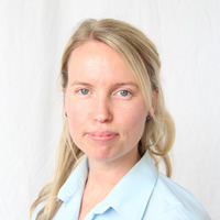 Sarah is the flood specialist at Manly Hydraulics Laboratory, with qualifications in environmental science. Sarah has 12 years’ experience in project management and the collection, statistical analysis, interpretation and reporting of environmental data. She has worked on a variety of hydrometric investigations for the NSW Office of Environment and Heritage, WaterNSW, Sydney Water Corporation and various local government agencies.
After: Extreme Flood Event Measurement Technique (Maximum Velocity Estimation)
Rebekah Webb—Ventia, Vic
Abstract
After the Victorian floods in 2010/2011/2012 and after having several acoustic Doppler current meters swept away in flood waters, an amended measuring technique was sought to reduce exposure time of both operators and instruments in extreme high flow events. The technique involved estimating discharge in rivers during events with extreme water velocities that prevent the application of other measurement methods.
The technique developed utilises previous high flow gaugings to determine the area of maximum velocity in the channel at the measuring site. Then, on a site specific basis, the relationship between maximum velocity and mean velocity is determined. The relationship is based on hydraulic depth at the site.
During the extreme event, only this maximum velocity point is measured. This reduces the exposure time of both the operator and instrument as only one point in the waterbody needs to be measured. Various other physical details of the site are noted at the time, including depth and time of measurement. If a cross section is available, the measurement may be calculated on the spot, however, this may need to be determined after the event depending on site conditions and safety factors. Using the site specific relationship, the maximum velocity is converted to mean velocity and then using the cross sectional area, an estimate of the discharge is determined. This technique results in a discharge value with an estimated error of approximately 10%.
Speaker bio
 Rebekah has over 16 years of experience in the environmental services industry, with extensive experience in all aspects of hydrographic work. Having worked initially in data collection, she moved into data management, then hydrology. She has developed the initial data processing and quality assurance/reporting processes for many contract requirements. Rebekah has experience in the calculation and maintenance of index velocity relations for use with acoustic Doppler technology and has developed several complex relationships for key monitoring sites. She has also acted as a tutor for those studying the Diploma of Water Operations (Hydrology).
She has been involved with several specialised projects for internal and external clients including flood management, flow balances, the calculation and examination of data for extreme events and the creation of specialised forms for repeat processes.
In 2014, Rebekah took over the role of Hydstra Administrator and in 2017 lead the project for the merging Ventia’s multiple Hydstra copies into one central location, to enable more streamlined data flow.
After: Continuous Water Quality Monitoring – How To Survive Extreme Events
Melody Wu and Roman Kadluczka—Manly Hydraulics Laboratory, NSW
Abstract
Continuous water quality monitoring sites are established to assess variations in the quality of surface water. Near real-time water quality data and easy to understand information presentation can help water authorities and the community to make informed water related decisions. However, with an increased risk of extreme weather events in Australia, like extended drought or extreme precipitation events, both capturing water quality data and presenting information is challenging. We explore these challenges in water supply tidal pools, where the transitional zone between the fresh and salt water impacts the extraction of water for irrigators, industry and local water supplies, especially during critical water shortage situations.
Extreme event water quality monitoring requires sound engineering and scientific practice. The overall design of the water quality monitoring sites and selection of the equipment are key to enable a station to adequately measure and maximise quality data capture. The station’s sensor selection, frequency of the sensor calibration, and field servicing and verification program, should be based on the objectives of the water monitoring program and recognition of extremes during its life.
Most of the common continuously monitored water quality parameters like temperature, pH, and dissolved oxygen usually remain within a reasonable working range during events. However, there can be drastic changes in conductivity/salinity readings during both dry and wet weather events, especially at the tidal interface. This challenges existing water quality data codes which vary across organisations and are often based on freshwater conditions. Absolute value based quality data codes can prove inappropriate for data end users and confuse the real value of the continuous data. Informed quality codes reflect the accuracy of the instrumentation selected, the maintenance regime and the full range of measurement experienced, including during extreme events.
Speaker bio
 Roman Kadluczka has over 24 years’ experience in the field of environmental engineering in Australia and overseas. During this period worked as researcher, developer of scientific equipment and computer programmer. He has extensive experience in the development of tools for data analysis and data presentation in the fields of computational fluid dynamics and environmental data. His experience is most significant as it enables him to combine engineering, scientific and computing capabilities to advance the development of data collection, analysis and presentation.
 Melody is a Project Officer at Manly Hydraulics Laboratory, with qualifications in environmental engineering and scientific management. Melody has over seven years’ experience in project management, the collection, analysis, interpretation and reporting of environmental data, and water quality instrument calibration and maintenance. She has worked on a variety of hydrometric and water quality monitoring projects for the Office of Environment and Heritage, the WaterNSW, and some local councils. Melody currently manages the fieldwork and reporting for a number of water level, rainfall and water quality recording projects throughout NSW.
After: From the Ashes – How the 2016 Waroona Bushfires are Influencing Future Catchment Management in Western Australia
Jacquie Bellhouse—Water Corporation of WA, WA
Abstract
In early January 2016 a major bushfire swept down from the parched Darling Escarpment and across the farms of Western Australia’s Swan Coastal Plain.
At its peak the fire was so large that it formed its own weather system. A massive cloud form, which generated its own unpredictable winds, lightning, and ember showers, the Waroona fire, could be seen from space and with the naked eye from Perth 118 km north.
Over seventeen days the fire burned a total area of 69,165 ha comprising 31,180 ha of private property and 37,985 ha of public land. One hundred and eighty one properties were destroyed. The small town of Yarloop, home to around 500 people, was virtually wiped out. Tragically, two residents also lost their lives.
It has been estimated that the cost of the fire, including the costs of suppression, losses, damage and recovery totalled approximately $155 million.
While the impact of the fire on the regions hydrometric monitoring network was, relatively, negligible, (costed at a $30,000 for the Corporation and $10,000 for the Department of Water and Environmental Regulation, DWER), the impact on the surrounding environs was significant.
Within the catchment of Samson Dam, the fire was extremely intense and wide spread. This resulted in extensive loss of vegetation and natural buffers within the catchment and surrounding properties. Most critically this included 100% of the riparian zones. This not only presented a high risk for erosion, and adverse water quality in supply reservoirs and the sensitive Peel Harvey Estuary, but also threatened the stability of local ecological communities including a settlement of Water Rats.
However at of the ashes a range of exciting opportunities, for water resource management in WA, has arisen. In fire prone areas of the south western Australia knowledge on the impacts of wildfire on water quality is relatively unknown. In the case of wildfire where water and aquatic assets are involved community, industry and resource managers have few means to prioritise their mitigation efforts. In the wake of the 2016 Waroona Fire a study utilised available discharge and water quality data to examine the role of wildfire in causing erosion and producing water quality impacts.
This paper will attempt to illustrate the short and longer term impact of this extreme incident on surface water monitoring and management within the region by:
- Presenting an overview of the immediate to medium term consequences of the fire on the local hydrometric networks;
- Examining the unique learning opportunities events such as these provide resource managers, including:-
- Insights into the observed impact of fire on the composition and overall health of the surrounding riverine ecology and its capacity for recovery from extreme events;
- Insight into how researchers could apply existing models capable of determining the spatial variability of soil erosion following fire in water source catchments;
- Insight into into how we might further improve existing hydrologic models such that they may be able to predict the possible hotspots for erosion and water quality prior to controlled burns.
Speaker bio
Jacquie is a Senior Technical Adviser with the Water Corporation of WA with extensive experience in Water Source Compliance, Water Resource Planning, Eco-Hydrological Investigations and Assessments, Hydrographic Monitoring and the management of Hydrometric and Environmental Data sets.
Her career started in 1995 while still earning her Bachelor of Science in Biology from Edith Cowan University, after which she returned to school to earn my Certificate IV in Hydrography from NSW TAFE. In 2017 she became a Certified Practising Hydrographer as recognised by the Australian Hydrographers Association (AHA).
In her spare time she volunteers as the AHA Journal Editor, AHA Committee member and has sponsored the work to review the National Hydrometric Guidelines 1 to 7.
Jacquie has over twenty three years’ experience in the Water Resources Industry.

