Abstracts and Speakers
Wednesday 29 October
Wednesday 09:15 Opening Speaker
Ray Boyton
Bio
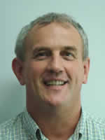
Ray Boyton has 40 years experience in Hydrography and the management of Hydrometric data and information within the NSW Office of water and its predecessor organisations.
Ray is currently (since December 2012) the Director Water Information within the NSW Office of Water. This position provides strategic leadership, direction, advice and support for NOW’s Water Monitoring activities and to manage the effective integration of NOW hydrometric services, water databases, spatial information, metering information, and internet water information capture and dissemination systems.
Prior to taking the Director’s position Ray was the Manager Water Monitoring from December 2006. This role was to provide strategic leadership, direction, advice, and support for NOW’s Water Monitoring activities and to manage the effective integration of NOW hydrometric services, water databases and internet water information capture and dissemination systems.
Entering the workforce almost straight from High School and without any Hydrometric skills he started as a Hydrographic Assistant in Tumut (Southern NSW) in July 1974 just months before the largest floods on record for many of the Murray-Darling rivers. It was six months later he learned how to assemble wading rods having learned by then to hate a 100 lb lead weight. Over the next 15 years he gained in depth knowledge of Southern NSW river and their gauging stations occupying a number of Hydrographic positions in Tumut, Parramatta and Muswellbrook.
In the early 1990s when water information collection and archiving was being rapidly transitioned from a paper based to electronic medium he moved into the data and database management starting as an assistant data processing officer. Skills previous gained as a field Hydrographer were in demand in the radically altered information management group.
This group was no longer converting large amounts of analogue data to digital format as this was being undertaken by field Hydrographers using data logger and software.
For 8 months during mid 2000s Ray was fortunate to be able to be part of the team that installed a national water database in Vietnam.
Wednesday 09:46 Special Keynote Speaker
Drawing Insights from Water Data – Challenges and Opportunities
Abstract
International and national news reports cover floods and droughts, the hydrological impacts of climate extremes almost daily. Monsoonal floods across Pakistan in September 2014 killed over 300 people and displaced close to half a million people costing billions. Currently, most of Queensland local government areas have been declared to be in drought. The economic, environmental and social impacts of interruptive events such as these are best managed through robust advanced planning and by providing early warning where possible. Hydrologic data play a key role in monitoring, assessing and forecasting not only floods and droughts, but also the availability of water resources in general. Australia has moved from a fragmented hydrologic monitoring and reporting past to a more centrally coordinated compiling and disseminating of water information data, products and services across Australia. The Australian Government’s $450 million 10-year Water Information Program initiated in 2007 has modernised and extended the hydrologic monitoring system, enabled receiving and archiving hydrologic data centrally, strengthened the flood forecasting and warning services, published National Water Accounts and Australian Water Resources Assessments and introduced a number of streamflow forecasting products, including seasonal and seven-day water forecasts. Challenges faced in ingesting large volumes of non-standard data and the assimilating information from numerous sources will be shared with the audience. Converting this data into information and insights will be demonstrated using a subset of the new products and services and their use in case studies.
Speaker bio

Dr Dasarath (Jaya) Jayasuriya is the Assistant Director for Water Forecasting at the Bureau of Meteorology, Australia’s national weather, climate and water agency. From August 2011 to April 2013, Jaya was a member of the Bureau’s Executive team and acted as Deputy Director of the Bureau’s Climate and Water Division. In this role, Jaya was responsible for the Improving Water Information Program, a 10 year, $450 million Australian Government initiative to monitor, assess and forecast the availability, condition and use of Australia’s water resources.
Dr Jayasuriya is one of the six members of the Expert Group established by the World Meteorological Organisation (WMO) to advise the global community on Climate, Water and Food Security. In addition, Jaya is also a member of the Flood Forecasting Initiative Advisory Group of the World Meteorological Organisation (WMO) and a member of the Advisory Board supporting the European Union funded recent initiative ’EartH2Observe’ (E2O) commencing in November 2013. Jaya also has experience working in Thailand on ADB funded projects as well as dealing with the irrigation sector and the disaster management sectors in Sri Lanka.
A civil engineer by training, Jaya completed his PhD from Monash University (Australia) in the mid 1980s and worked at Melbourne Water for 22 years prior to joining the Bureau in 2009. During this time Jaya was responsible for the strategic planning of Melbourne’s water supply system that included the management of over 150,000 ha of protected forested catchments supplying water to a city of 4 million people. Jaya has contributed to water resources management and water reform at the national, state and regional level for over 30 years including extensive work with local government developing sustainable water strategies and water conservation measures.
His expertise spans environmental water, flood forecasting and warning, drought management, water resources allocations and optimization, and institutional governance.
Wednesday 11:01 Hydrography underground: Keynote Speaker
Groundwater interaction with rivers: Current understanding and research needs
Abstract
Effective conjunctive management of surface water and groundwater resources requires a detailed scientific understanding of the nature of the interaction. This required understanding can be broken down into three key information needs. Firstly, we need mathematical models for predicting changes in surface resources that arise from changes in groundwater systems, and vice versa. We need to know the strengths and weaknesses of these models, and the uncertainties involved in their use. Secondly, we need estimates of the surface water – groundwater exchange flux. The magnitude of the exchange flux determines whether conjunctive management is required, and defines the degree of over-allocation that may arise if surface water – groundwater interaction is not explicitly considered. Estimates of the surface water – groundwater exchange flux, and its spatial variability, are also key data requirements for calibrating numerical models that are used for predictive purposes. Thirdly, we need an understanding of the connectivity status of the surface water – groundwater system, and how this varies spatially. Knowledge of the connectivity status is important for appropriate model selection, and also for choosing appropriate techniques for quantifying the exchange flux.
While a number of models are available for predicting changes in surface water flows due to groundwater pumping, the potential for changes in surface water flow to impact groundwater recharge from streams appears to have been largely overlooked. Also, while there are numerous methods for quantifying surface water – groundwater exchange, most of these operate on very small spatial scales and results from them cannot be readily extrapolated to catchment scales. There is potential to estimate exchange fluxes over large scales using downstream changes in river chemistry and temperature, and sensors to automate collection of this data are readily available. However, we need to understand better how other processes influence river chemistry and temperature. Connectivity mapping is also proving difficult at large scales, particularly when observation bore networks are sparse and aquifer hydraulic properties are poorly known. Further research is needed in all of these areas.
Speaker bio
 Peter Cook is a Senior Research Scientist with CSIRO and Professor of Hydrogeology at Flinders University. Between 2009 and 2014, he was Deputy Director of the National Centre for Groundwater Research and Training (NCGRT), and the Program Leader for the Surface Water – Groundwater Interaction program. One of Australia’s foremost groundwater scientists, Professor Cook has more than 20 years experience in groundwater research, spanning the fields of groundwater hydrology, ecohydrology, isotope hydrology, unsaturated zone flow process, and surface water – groundwater interaction. He has co-written books on environmental tracers and ecohydrology. He was the National Ground Water Association’s Henry Darcy Distinguished Lecturer in Ground Water Science in 2009, the only time this honour has been awarded to a scientist from outside North America.
Wednesday 11:30 Hydrography underground
Monitoring Coal Seam Gas in NSW – Some of the Issues facing NSW
Abstract
An examination of coal seam gas activities in NSW. Where it is, what it is, some of the major public concerns and what the NSW government and the NSW Office of Water are doing to minimise and monitor possible impacts. The involvement of Hydrographers and the hydrographic profession in these activities is also examined.
Speaker bio
 I started in Hydrology Unit and worked there for 10 years undertaking a range of hydrologic and hydraulic analysis and modelling works. For another decade or so I moved into the data processing/management area as the project manager for the installation of the original Hydsys system on a Fujitsu mainframe computer. After several years in the TQM/QA area looking at general hydrometrics activities I returned to the data and application system support area where I have remained in various guises ever since.
I am currently managing NOW’s water information systems.
Wednesday 12:00 Hydrography underground
Soil moisture monitoring in Southland, New Zealand
Abstract
This report details the inception, methods, development and issues that were encountered with the Environment Southland soil moisture monitoring network in New Zealand. In response to the new National Environmental Monitoring Standards (NEMS), Environment Southland is investigating what this means for the way the organisation monitors soil moisture and assess how to implement these for the soil moisture monitoring network.
The Environment Southland monitoring network provides a tool used by farmers to guide them with the management of the disposal of farm dairy effluent. The soil moisture data is also used in a range of other projects including catchment runoff and flood warning modelling, generating more precise assessments of groundwater recharge, water use and allocation efficiency.
The soil moisture and temperature data is available on Environment Southland’s website, which is a valuable tool for many farmers and frequently visited.
There have been a few issues setting up the network in regards to the correct installation depth of the soil moisture sensors and the bedding in process. This has been highlighted with the installation of two sensors at each site as part of the instrument replacement schedule where a difference has occurred between the two sensor readings. With these variations in soil moisture readings, questions arise around the difference in installation depths.
Until recently, the Environment Southland soil moisture network has grown rapidly without many robust standards in place. The new National Environmental Monitoring Standards will create consistent processes and management of environmental data monitoring in New Zealand.
Speaker bio
 I began my career as a Hydrologist at Environment Southland in 1995, straight from high school. I have studied at Massey University majoring in Geography while still working full time and have yet to complete this qualification.
During my time at Environment Southland I specialised in groundwater for around six years where I learned a great deal about Southland’s unique groundwater quantity and quality issues. In 2012 I was promoted into a senior role within the Environmental Data collection team. This year I was further promoted to the principal environmental technical officer role where I lead a team of seven officers collecting information from air, soil, surface water and ground water environments. I have nearly 20 years in the environmental data collection field and still enjoy every aspect of the industry.
This will be my second time presenting at a conference after winning the presentation competition at the New Zealand Hydrological Society’s conference in February 2013.
Wednesday 13:30 Hydrography underground
Bore Hole Monitoring – Coal Seam Gas Projects Southern Queensland
Abstract
This paper details Bore Hole Monitoring and IP telemetry for coal seam projects in Southern Queensland for the large Oil and Gas companies / Unconventional gas companies.
This paper outlines the practical experiences of monitoring of groundwater levels in bores in remote regions and the technical challenges associated with maintaining very remote monitoring.
The paper focuses on actual field experiences, sensor types, telemetry types, satellite and Next G alternatives, location issues, dealing with livestock, working on local landowners’ property, power sources, repair and maintenance issues.
Speaker bio
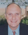 Matt Saunders is the General Manager of Unidata Pty Ltd, a long established environmental monitoring and industrial measurement manufacturer.
Matt Saunders has more than 25 years of senior management and ICT project management experience and a track record managing large technology projects within Australia and internationally. Matt started his career with a cadetship from OTC, the international arm of Telstra, studying Electronics and Communications at NSW Institute of Technology Gore Hill campus, which later became part of University of Technology Sydney, and then working in the satellite industry at the Carnarvon Tracking Telemetry and Command (TT&C) Satellite Earth Station run by OTC for Comsat in Washington. Matt then worked for Hewlett Packard in engineering and in a software applications role for some years. Matt then established a Network Management Software company, which grew to a large company over many before the company was purchased by Northern Telecom ./ Nortel Networks. Matt has been an active member of the Institute of Radio & Electronics Engineers (IREE) and the IREE Communications Society. (IREE COM SOC) for many years.
Wednesday 14:00 Hydrography underground
From the Walls to the Ocean: An overview of contemporary hydrography in the city
Abstract
Sydney Water Corporation has a Hydrometric Services Group (HSG) which is responsible for measuring clean and dirty water throughout the Sydney Water network. The network spans from Warragamba Dam, where fresh, raw, untreated water enters the delivery network and works through many and varied processes ending up as potable drinking water, used by our customers and eventually discharged via direct or indirect means to the Pacific Ocean. Throughout this large and interconnected network of underground pipes, sewer carriers, filtration plants, pumping stations and water and wastewater treatment/recycling plants, hydrographers are required to accurately measure levels, flows, rainfall and related parameters for various asset management, planning and environmental protection and licence purposes. Within the HSG Operational group, six teams of hydrographers are engaged in the routine monitoring of stages of the network: 1) potable water pressure and flow 2) sewer level and flow 3) wastewater treatment/recycling plant influent, effluent bypasses and overflow.
This paper will provide an overview of the current hydrometric activities that Sydney Water “city” hydrographers face day to day, with focus on some of the complexities of accurately monitoring underground sewers and treatment/recycling plants in order to provide efficient water and wastewater services to a city of over 4 million people while protecting public health and the environment now and into the future. Insight into why these measurements need to be undertaken and where, how they are carried out, the associated hazards involved and current and future projects are included.
Speaker bio

- 2007-2011: Bachelor of Science Advanced First Class Honours, University of Wollongong
- 2012: Research assistant, School of Earth and Environmental Sciences, University of Wollongong
- Jan 2013-current: Assistant hydrographer,Sydney Water Corporation
Since starting university back in 2007, I have developed a passion for learning about the earth sciences. My final year at University allowed me to use this passion to undertake meaningful research in the earth science field. After completing university, I gained experience contributing to peer-reviewed publications, specifically, I helped create paleo-climate data from the geochemical signatures in fossilised corals. After university, I gained employed with Sydney Water — hydrometric Operations. I particularly enjoy my role at Sydney Water because of the variety of field- and office-based work I do, the project management experience I gain and because it allows me to work with an industry leader in the hydrometric field.
Wednesday 14:30 Hydrography underground
Applying Traditional and Not So Traditional Hydrographic Techniques to Maintain Security of Supply Under a Drying Climate
Abstract
The Corporation has adopted a security through diversity approach in managing water supplies to Perth, however continued changes to our climate and population growth mean there is still a need to maintain supplies from “traditional” surface water and groundwater sources.
This paper aims to demonstrate how the Corporation is applying various hydrographic techniques to maintain the security of supply from climate dependant sources:-
- Case Study 1: Wungong Catchment Environment and Water Management Project
- Case Study 2: Managing shallow groundwater resources in water-limited ecosystems
Speaker bio
 Jacquie Bellhouse is currently a Water Services Strategy Adviser with the Water Corporation of WA. Jacquie’s role is to to provide technical advice and lead teams in the planning and investigation of water and wastewater services across the state. Jacquie moved into this role after fulfilling roles as an Engineering Hydrographer and Team Leader Hydrographic Projects.
A second generation Hydrographer Jacquie has worked exclusively in the in the Water Resources Industry for 20 years with extensive experience in Hydrography, Water Resource Investigation, Water Resource Planning, Water Source Compliance, Data Management and a passion for all things Eco-hydrological. Jacquie currently specialises in:-
- Coordinating feasibility studies on the engineering, environmental, social and economic aspects of water and wastewater service proposals;
- Leading investigations and providing specialist advice regarding Groundwater and Surface Water Dependant Ecosystems;
- Leading improvements in systems and methods for the collection and provision of hydrological information in accordance with quality principles;
- Leading discussions with regulators in order to establish appropriate levels of regulation accounting for economic, environmental and social aspects;
- Liaising with the Community, Clients, Regulators, Government and other key stakeholders;
Jacquie is also the current chair of the Hydrometric Standards TRG. As the chair Jacquie is committed to their having an ongoing role in the revision of and development of new guidelines.
Jacquie graduated from Edith Cowan University in 1995 with a Bachelor of Science in Biology and went on to obtain her Certificate IV in Hydrography from NSW TAFE in 2009.
Wednesday 15:30 Hydrography above ground: Keynote Speaker
When good models do more than advance the cause of fashion …
Abstract
The Hawkesbury-Nepean River basin lies to Sydney’s west and has a number of regions designated for significant urban growth in coming decades. These include the Macarthur South, the South West and the North West Growth sectors. The population in these regions is expected to grow by almost 1 million people by mid-century.
The Hawkesbury-Nepean River and catchment are important environmental, agricultural and recreational assets, and urbanisation will require significant planning in terms of water and wastewater servicing. Extensive planning is underway to ensure that growth can be accommodated while balancing the needs to protect environmental and community values.
To quantify the relationship between growth and longer-term river health, an integrated series of catchment, hydrodynamic and water quality models were built for the Hawkesbury-Nepean River system. These will assess an extensive range of future growth and infrastructure scenarios so as to understand which options have the least impact and potentially greatest river health benefits. These will in turn guide capital works programs by allowing more objective comparisons of likely water quality benefits against expenditure for different options.
While the model development has been a significant investment, the work has also been underpinned by a comprehensive monitoring program, aimed at providing the evidential basis for model validation and calibration. The monitoring has comprised integrated water quality, hydrological and hydrometric programs.
This paper shares key aspects of the journey with the audience by outlining the challenges and learnings encountered, and how its findings are being used to inform strategic planning and what are the policy and licencing implications for setting long-term environmental targets for managing the river system.
Speaker bio
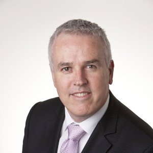 Greg is Sydney Water’s Manager Corporate Strategy and has over 20 years’ water industry experience. In this role, he manages the development and alignment of the corporation’s strategic plan as well as customer value, science and research and development strategies. Greg sits on a number of inter-agency working groups addressing urban water and wastewater planning, climate change adaptation and national urban water research. He is also a member of the American Water Research Foundation’s Focus Area Council. A key component of his current role is overseeing critical investment in Sydney Water’s water quality modelling capability, which includes the Hawkesbury Nepean River system and major Sydney coastal estuaries.
Wednesday 16:00 Hydrography above ground
A Look into the Hydrology System of Ventura County, California, USA
Abstract
This will be an overview of the surface water quantity hydrology system of Ventura County from the ground up. A look at hydrographers in Ventura and the tasks that are performed. An overview of the different types of equipment used in Ventura and how that equipment is installed. A look into the different ways the data is telemetered, collected, processed and made available to the public. Concluding by covering specialty equipment and tools used for stream measuring and simplifying the job along with what the future may hold.
- Hydrology Section Overview
- Hydrographer Tasks
- Types of Equipment
- Data Collection and Distribution
- Equipment for Special Needs
- A Look at Ventura County’s Future .
Speaker bio
 Ron started his hydrology career in February 1997 when he started as an intern for Santa Barbara County. After only few months they hired him on as extra help where he stayed for about a year until he finished his BS degree in Hydrological Sciences from the University of California Santa Barbara. He was then hired by the County of Ventura in July of 1998 where he continues his career to this day. He has been a board member of the ALERT Users Group since 2008 and received his Professional Hydrologist Certificate from the American Institute of Hydrology in February 2011.
Wednesday 16:30 Hydrography above ground
Lahar Monitoring in the Central Plateau, NZ – Mt Ruapehu and the Whangaehu valley
Abstract
This paper introduces audiences to the Horizons Regional Council (HRC) lahar monitoring system on Mt. Ruapehu and the Whangaehu River in the Central Plateau of New Zealand’s North Island. The causes and effects of this destructive natural hazard are explained as are the impacts these can and have had on the local area including the risks to public safety, river health, and infrastructure. The history of lahar monitoring in the region is outlined before focus is turned to the implementation of the current monitoring network which has been upgraded by Horizons and Massey University over the past 8 years, with permission and assistance from local Iwi Ngati Rangi.
This network overview focusses on the technical application and installation of monitoring equipment, especially the installation of a web camera and radar at the Tukino ski-field on Mt Ruapehu, the installation of a web camera, radar, and water quality sensors at the Tangiwai memorial, and the installation of a web camera monitoring Crater Lake on Mt Ruapehu. The issues associated with the installation and maintenance of these sensors in one of the harshest environments in the country is also detailed. The low pH of the Whangaehu River proved an issue for in-situ sensors as did the high risk of damage from lahars. On the mountain itself the extreme low temperatures proved an issue for electronic equipment, and extreme winds and harsh scoria also combined to damage the web camera lens and lead to innovations in the deployment of these instruments in harsh environments. The monitoring and sampling procedures during events are explained and the monitoring of the last lahar event in 2007 with recorded stage heights, photos, and videos capturing the event, is outlined.
Speaker bio
 I have been working for Horizons Regional Council, based in Palmerston North, for the last 6 years in the catchment data (environmental monitoring) team after graduating from Massey University with a Bachelor of Arts in Geography.
I spent the first 5 years with the council as a Catchment Data Technician and was part of the team that upgraded the lahar monitoring system outlined as well as maintaining other environmental monitoring sites throughout the region including river flow, water quality, climate, and air quality monitoring recording sites. I am now a Catchment Data (Environmental) Analyst within the same team, however still have strong ties to the fieldwork being undertaken in the region.
I have presented an overview of the current lahar monitoring system at the 2013 New Zealand Hydrological Society workshop, and have elaborated on that, as well as providing an overview of lahar risk in New Zealand in general, as part of this presentation.
Thursday 30 October
Thursday 09:00 Hydrography above ground
NSW Sea Level Trends – The Ups & Downs
Abstract
Following the abolishment of the NSW Sea Level Rise Policy Statement in September 2012, there has been great interest in NSW sea level records to provide often misguided “evidence based” estimates of local/regional sea level trends. One of the great difficulties in climate change and sea level rise planning is that the level of common knowledge on the subject is highly diverse, often biased by urban myths and interspersed by detailed knowledge in particular aspects with poor overall congruence of fact and meaning to a particular issue at hand. This paper will help develop a good understanding of undisputed baseline ocean water level drivers and responses across different timescales to avoid misinterpretation of sea level data. It also will demonstrate how despite over 25 years of highly valuable continuous quality controlled sea level data available for NSW, sea level rise trends based on these and other historical data are not necessarily representative of expected future long-term sea level change.
The paper will describe where sea level data is collected in NSW and how it is measured both today and in the past, including NSW’s longest records from Fort Denison which commenced in 1886 and provide quality controlled sea level data since 1914. The importance of maintaining recording station metadata will be demonstrated, including instrumentation details, datum changes and monitoring intention(s), as the future value of data will be highly dependent on traceability of these metadata. Through the NSW State Government’s recognition of the value of sustaining continuous quality controlled coastal data, the importance of NSW sea level records continues to increase, both in day to day activities and far longer-term. The paper will discuss key factors necessary to ensure that continuous data collection activities can be sustained. This includes understanding both the physical process development and effective communication of the value of these data.
Speaker bio: Ed Couriel
 Ed is the Principal Engineer at NSW Public Works MHL. He has over twenty years’ experience in coastal, estuarine and other water engineering studies, having held numerous senior positions responsible for large multi-disciplinary teams including GHD Service Line Leader for Integrated Water Management, Sydney Water’s Monitoring Information Systems, Hydrometric Services, Science and Technology and System Services Groups.
Ed previously led the Coasts and Estuaries Group at the Water Research Laboratory. Ed specialises in coastal, estuarine and riverine physical processes.
He has led numerous Australian and international investigations (including Singapore, Malaysia, Thailand, China, New Zealand, Argentina) and has been involved with several major and award winning projects including physical modelling studies associated with Sydney’s deepwater ocean outfalls that won two Engineering Excellence Awards (for Research and Development, and for the Environment).
Speaker bio: Ben Modra
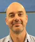 Ben Modra is a Project Engineer in NSW Public Works MHL’s coastal and hydraulic engineering group. Over the last seven years he has specialised in the study of the broad data network managed by MHL and other sources in NSW, with a particular focus on tides and methods of tidal analysis. He is also involved in a range of coastal studies and physical modelling projects for coastal and hydraulic applications, and specialises in instrumentation for both laboratory and field monitoring.
Thursday 09:30 Hydrography above ground
Melbourne Water: A Diverse User of Hydrographic Data
Abstract
Melbourne Water is a statutory authority owned by the Victorian government. We manage water supply catchments, treat and supply drinking and recycled water, remove and treat most of Melbourne’s sewage, and manage waterways and major drainage systems in the Port Phillip and Westernport region. We deliver a variety of projects and services to lessen flood risk.
Given these important functions, Melbourne Water has identified the value of hydrography to our business, and as such allocates resources and expenditure for the provision of a dense hydrographic monitoring network across the natural and urban catchments in our area of jurisdiction.
The Hydrology and Flood Warning Team within Melbourne Water is charged with maintaining this network and providing high quality fit for purpose data, which assists the organisation to achieve its vision of Enhancing Life and Liveability for the people and community of Melbourne.
Our hydrographic data is widely used across the business to manage such programs as river diversion licences, strategic planning for future growth, operational purposes, water supply monitoring, sewage transfer, bulk water entitlements, environmental flows and flood warning and response.
Managing our own network of sites allows us to be one of the few organisations in Australia to generate our own flood warnings which are issued in conjunction with the Bureau of Meteorology. The Hydrology and Flood Warning team is made up of Hydrographers, Data Engineers and Hydrologists working together and monitoring the network 24 hours a day to provide this vital service to Greater Melbourne.
In the ensuing paper we briefly discuss the importance of Hydrography in Melbourne Water, the history of flood warning in Melbourne and explain the comprehensive process developed to deal with flood incidents.
Speaker bio: Jess Egan
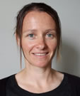 Jess has been working as an engineer in the water industry for eight years.
After a brief stint assisting with engineering solutions to factory waste management while working at GM Holden’s engine plant, she moved across to Melbourne Water where she was part of the civil asset management team overseeing water supply infrastructure including dams, weirs and aqueducts.
In 2010 Jess took up a role within the Hydrology and Flood Warning team, where she has been involved in data quality auditing, data management using Hydstra, flood warning and response activities, hydrological modelling and mapping. Throughout this time Jess has also been exposed to field hydrology and gauging, project management and instrumentation. Jess has a keen interest in weather, hydrology and water resources.
Outside of work, she enjoys getting out into the great outdoors is involved in community sport and triathlon.
Speaker bio: Michael O’Hagan
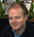 Michael has worked in the Hydrographic industry in Melbourne for 8 years.
Having moved to Melbourne from Ireland in 2006, He joined ALS working as a hydrographic contractor on Melbourne Water’s extensive hydrological monitoring network. Duties were assisting in the installation, commission and ongoing maintenance of the monitoring sites including data collection, gaugings, rating table maintenance and data editing and archiving.
Michael moved across to the Hydrology and Flood Warning team at Melbourne Water in September 2013. As part of the team, he helps manage the maintenance and ongoing improvements to Melbourne Water’s existing Hydrographic Monitoring network as well as being a duty officer in Melbourne Waters provision of flood warning.
Outside of work Michael is a keen golfer and avid follower of all sports.
Thursday 10:00 Hydrography above ground
Is yesterdays high stage modelling, still todays high stage rating?
Abstract
This report documents the process used to confirm a modelled high stage rating for the Namoi River at Mollee. It involved reviewing a flood mitigation study done in 1980 and comparing it to known gaugings throughout the life of the station and the extrapolation gained through theoretical analysis.
The Mollee gauging station is a significant monitoring point in the Namoi catchment as it is approximately half way through the catchment. This gauging station indicates what type of flood impacts water will have on the remaining Namoi River townships and river sections of Wee Waa to Walgett after going through Narrabri and then downstream further from Walgett to Bourke on the Barwon Darling system.
The results confirm the findings of the flood mitigation study completed in 1980 and through theoretical analysis modern day gaugings appear to fit with extrapolated high stage rating. This study showed that through various means, previous modelled high stage ratings can be validated through the combination of actual measurements at a site and theoretical analysis.
Speaker bio
 Raised on the North Coast of NSW, Daniel completed a Bachelor of Applied Science (Environmental Resource Management) at Southern Cross University in 1998 and has recently completed the Diploma in Water Operations through OTEN (2013).
Daniel first worked as a manager in hospitality for a year in his home town of Casino before applying for a 3 month temporary position in Narrabri in 2000 with the now NSW Office of Water and has been there ever since. Daniel started with Hydrometrics as an assistant but soon was running a network of hydrometric stations. He is now a Supervising Hydrometric Officer and apart from a two year stint working for NSW State Water Corporation as a River Operator/Customer Service Officer has held that position.
Throughout his hydrometric career Daniel has carried out routine hydrometric duties and flood gaugings across the north of NSW from Bourke in the west to the Far North Coast but his main area is the Namoi and Barwon catchments.
This is Daniel’s first AHA conference.
Thursday 12:00 Hydrography above ground
Burnett River Floods and Gauging & Rating Implications
Abstract
The Burnett and surrounding basins had large floods in 2010 and 2013 after 72 hr rainfalls of up to 1372 mm, with peak discharges as high as 17000 cumecs.
Bundaberg hydrographers gauged flows of up to 7329 cumecs, including some ADCP comparisons up to 4095 cumecs. They were banned from gauging the large flood peak because of the unprecedented helicopter rescue efforts in North Bundaberg. They also liaised extensively with BOM Flood Warning staff about instrument problems upstream, and re-rated the most critical flood warning site before it peaked.
Innovative ADCP gauging techniques were used because of high water velocities of up to 6.57 m.s-1. Likely sources of uncertainty for both current meter and ADCP gaugings are discussed. Loop ratings are evident from headwater-tailwater flood level correlations at Jones Weir and Ned Churchward Weir. It is suggested that hydrographers should routinely adjust gauged unsteady flow to quasi-steady flow equivalents, using the advection and diffusion terms of the St Venant equations.
The largest and deepest river channels had easily-visible vegetation destruction, resulting in flood rating changes of possibly up to 25%. It is hypothesised that vegetal resistance for such large streams is at a maximum at the bottom of the high-flow rating segment, and decreases to a minimum at bankfull. It is similarly hypothesised that if a good GH-Area power law can be fitted to a rating segment, then it’ll also have power laws for mean velocity and thus discharge.
A variable-exponent power-law GH-Q rating curve is suggested as a more rational way to analyse flood hydraulics than using a fixed-exponent relationship like GH vs Q0.4 or Q0.5, or log-log rating curves. Such rating analyses should be done for relatively few rating segments (e.g. 4) that can easily be identified from cross section surveys, and could sometimes be calibrated using only one gauging per segment. A zero-plane adjustment should be applied to calculated sectional areas when rating streams with large waterholes.
Single-section rating extrapolations are suggested as a viable alternative to more complex step-backwater model analyses below bankfull in alluvial channels without significant rockbars. However, the step-backwater model has advantages on floodplains that are constricted downstream or even upstream by impinging hills.
Accurate flood slopes are often difficult to obtain, but approximate bed slopes can easily be calculated by differentiating a polynomial trendline fitted to bed level data from long section surveys or contour maps.
RTK has recently been used for post-flood cross section surveys, and Lidar data has proven invaluable to augment that data in densely-vegetated parts of a section, or to extend earlier surveys above the maximum flood level.
Data on large floods are invaluable for rating validation by water balances, as runoff is then relatively much higher than the losses. Logged rainfall hyetographs yield clues on flood initial & continuing losses and thus their relationship with runoff depths. It is thought that flood warning models for mountainous catchments often use rainfall inputs that are biased low, and can give misleading calculated runoff and rating curves, but give good flood height forecasts.
Speaker bio
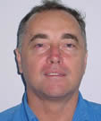 Ray Maynard is the Supervising Hydrographer at the Department of Natural Resources and Mines in Bundaberg.
He started work in Mareeba on 20 February 1975, and just over a week later camped out for an enjoyable 22 days flood gauging the Wenlock River on Cape York Peninsula. He worked for 2½ years in far north Queensland, where average annual rainfalls are as high as 7500 mm. Work in the remote areas entailed long dry-season vehicle trips (up to 29 days) with frequent camping, but there were also shorter and exciting wet-season helicopter trips. He transferred to Bundaberg in August 1977, encountering most of the many facets of hydrography. In 1988 he was a member of a team that gauged up to 9450 cumecs in the Fitzroy River at The Gap, possibly then the largest and deepest high-velocity (up to 3.63 m.s-1) flows fully measured by boat and current meter in Australia?
In 1991 he undertook an exhaustive flood study of the lower Burnett River, analysing and documenting many historic flood heights and anecdotes ranging back to the 1850s. The report has since been used innumerable times, including by consultants doing several generations of Bundaberg flood studies.
In 2011 Ray was a member of a BOM-sponsored committee that compiled several ADCP Standards documents, and his ADCP Troubleshooting guide was included.
He’s a voracious reader outside of work, with particular passions being meteorology & climate, hydrology, hydraulics, ADCPs & H-ADCPs, farming, trees, and conspiracy theories!
Thursday 13:30 Breaking ground in hydrography: Keynote Speaker
From Haiti to Typhoon Haiyan: Insights from Google’s Crisis Response Team
Abstract
Google Crisis Response makes critical information more accessible around natural disasters and humanitarian crises, such as floods, fires, hurricanes and earthquakes. This initiative is a project of Google.org, which uses Google’s strengths in information and technology to build products and advocate for policies that address global challenges.
The types of activities Google’s Crisis Response team might initiate include:
- Organizing emergency alerts, news updates and donation opportunities, and making this information visible through our web properties or dedicated Landing Pages
- Building engineering tools that enable better communication and collaboration among crisis responders and among victims such as Person Finder
- Supporting responders in using core Google tools, including Google Apps and Google Maps
- Providing updated satellite imagery and maps of affected areas to illustrate infrastructure damage and help relief organizations navigate disaster zones
- Supporting the rebuilding of network infrastructure where it has been damaged to enable access to the Internet
- Donating to charitable organizations that are providing direct on-the-ground relief
Google assesses the scale and scope of each disaster to determine whether and how Google can uniquely contribute tools or content to relief efforts.
Speaker bio
 Anthony Baxter is a software engineer who works with Google.org’s Crisis Response Team building tools to collect and share emergency information during natural disasters, including the Christchurch Earthquakes, Queensland Floods, Thailand and Philippines Floods, and Hurricane Sandy.
The Crisis Response team’s mission is: to deliver accurate, relevant and credible information to the public, leveraging Google’s reach and scale, for all emergency events affecting life and property as fast as possible across many Google products.
Thursday 14:00 Breaking ground in hydrography
Monitoring visible flows using web enabled remote camera technology
Abstract
This paper highlights the application of state of art remote camera technology that is utilized to interpret and deliver visible flow criteria to Water Sharing Plans.
In NSW, Water Sharing Plans have been developed with the criteria for cease to pump rules being “visible flow” or very small flow rates as low as 1 Ml/D. The ‘visible flow’ condition allows water extraction while the water source still has surface water flowing.
These very low flows are near impossible to measure accurately via a conventional gauging station. The flow conditions outlined in water sharing plans are based on the 09:00am instantaneous flow conditions in the stream.
Five sites across northern NSW have been an on-going project to demonstrate and deliver real time information as both data and photographs to stakeholders via web based interfaces.
Remote cameras can provide an alternative monitoring approach that is both cost effective and efficient in an age where real time information is expected and budgets mean employing smarter provision of data.
Speaker bio
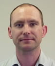 Andrew joined the ranks of hydrometric discipline in 1993 after completing his Bachelor degree in Applied Science. His studies include fisheries management, oceanography, bio-economics, hydraulics, engineering design, business management and project management. Beginning in the old Department of Water Resources, he has seen the change from strip charts and analogue current metres to the technology of real time data being delivered to the web and acoustic current profilers in Q-boats.
Andrew began as a temporary assistant in Armidale before winning a permanent position at Narrabri. He then moved to Dubbo before transferring to East Maitland hydrometric unit where he maintains a role of project manager. With over 20 years experience, he currently managers a range of projects including NSW Office of Water Hydrometric Asbestos Remediation Program, Remote Cameras and MHL/NOW Estuary Salinity Monitoring Program. He also undertakes an active role within NOW Hydrometrics auditing program, participates on the WHS committee and struggles with SAP. Andrew is married and outside of work, renovates his home, enjoys travel, good coffee and father/son time in the man cave.
Thursday 14:30 Breaking ground in hydrography
Use of a multibeam system to conduct a bathymetric survey of a reservoir and accurately assess storage capacity
Abstract
Multibeam hydrographic surveys provide extremely dense data sets effectively mapping the entire surveyed area allowing for visualisation of reservoir bathymetry. The multibeam survey system emits multiple “beams” of sound waves in a fan-shaped pattern to produce a swath of sounding data in a single pass over an area of the bed as distinct from the single beam system which measures depth at one point only. Multibeam sonar has become the standard in coastal and offshore seafloor surveying and the technological advancements in the last 5 years have seen it being implemented more and more in shallow waters. Apart from the increased resolution of the data set collected, multibeam sonar can also reduce survey times dramatically since each pass covers large areas.
A multibeam hydrographic survey was conducted on a 46km2 reservoir in Malaysia in 2011. Updated reservoir volume and surface area elevation curves were required being critical tools for the management of the dam. A review of current single beam and multibeam sonar survey technologies is detailed as well as the decision process that led to the survey method selection for the assignment. The survey including planning, methodology, data collection and post processing is discussed as well as the quality assurance and quality control program implemented. Finally, the outputs are described and the question whether the survey technique improves value and productivity is addressed.
Speaker bio
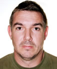 Justin Stockley graduated with honours in Environmental Science in 1997 from the University of New South Wales. Shortly thereafter, with the promise of abseiling down manholes he joined the Hydrographic Projects Group in Sydney Water. After 3 years Justin then joined Greenspan Technology and was based in Singapore for 11 years before returning to Perth.
Justin has been working in the environmental monitoring arena for 13 years, successfully project managing and executing projects in Australia, Singapore, Malaysia, Hong Kong, and the Middle East.
Thursday 15:30 Breaking ground in hydrography
National Industry Guidelines for Hydrometric Monitoring – Adoption and Implementation at a national level
Abstract
In May 2013, the Water Information Standards Business Forum endorsed 10 National Industry Guidelines for hydrometric monitoring. The endorsement of the guidelines was a significant achievement for the collaborative development of national standards in the water resources sector. The guidelines provide an opportunity for all water resource monitoring organisations to align their hydrometric monitoring activities with nationally consistent practices and implement common quality standards. With increasing adoption rates, the guidelines will in time allow effective benchmarking of hydrometric data across organisational and jurisdictional borders.
This paper presents findings to date from a survey of key water monitoring agencies across Australia, examining the current status of adoption of the 10 guidelines and the pathway to increased levels of implementation.
Survey responses indicate that all organisations share the vision of striving towards nationally consistent hydrometric monitoring standards. A high proportion of the new guidelines have so far been adopted by a majority of key organisations surveyed, and they have indicated willingness to increase levels of implementation into the future. Some organisations have identified barriers to adoption including a lack of resources and cost of training.
Speaker bio
 Linton Johnston’s career has been dominated by an interest in all things water. With a civil engineering background, and after an initial foray into the construction industry, Linton worked in research consultancy at the University of South Australia with a focus on innovative stormwater design and irrigation technologies. He later gained employment with Australia’s Bureau of Meteorology as an engineering hydrologist where he has worked in flood prediction and warning and water information coordination roles.
Linton’s most recent work at the Bureau is in the areas of water information standards and development of the Water Regulations. Linton also helped oversee administration of the $80 million Modernisation and Extension of Hydrologic Monitoring Systems program, which has brought significant benefit to the Australian hydrographic community over the past 5 years.
He can be reached at l [dot] johnston [at] bom [dot] gov [dot] au
Thursday 16:00 Breaking ground in hydrography
The Cost/Value of High Stage Gaugings – The 2012 Culgoa River Flood
Abstract
Should we be looking at the cost or reflecting on the true value in obtaining data from high stage gaugings?
This paper focuses on the 2012 Culgoa River at Brenda flood and highlights the importance of aerial support when conducting large flood plain gaugings to obtain results not previously possible. The costs involved were significant, however the teams would not have gained confidence in the results that were collected and may have lost/damaged traditional vehicles whilst attempting access without air support.
With the advancement in technologies, such as Acoustic Doppler Current Profiler (ADCP), access to sites is a key limiting factor. The following paper uses the Culgoa River Flood of 2012 as a case study to highlight the value of data obtained during the gauging exercise with the use of aerial support from both rotary and fixed wing aircraft.
Speaker bio: Roger Patricks
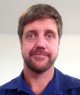 Born and educated in Armidale, Roger completed a Bachelor of Natural Resources (B.Nat.Res.) at the University of New England in 1995.
Since then Roger has worked in the environmental monitoring, waste management and now Hydrometric fields. Roger first worked with Sydney Water’s Residual Management branch for over 4 years before working with a private environmental consultancy firm back in his home town of Armidale. After a short stint of owning and operating a small retail business with his wife while raising a young family, Roger returned to the environmental field of Hydrometrics in late 2009.
Roger started with Hydrometrics as an assistant but quickly took on extra responsibilities. Roger is now a Senior Hydrometric Officer and since the recent wet years from 2010 to 2013, Roger has been busy undertaking routine hydrometric duties and flood gaugings across the north of NSW from Bourke in the west to the Tweed Heads on the Far North Coast. This is Roger’s first AHA conference.
Posters Wednesday and Thursday
Water Industry Guidelines – Adding Groundwater to the Mix
Abstract
In May 2013 The Water Information Business Forum (the “Forum’) endorsed 10 National Industry Guidelines for hydrometric monitoring (referred to hereafter as the National Industry Guidelines). Whilst a number of these National Industry Guidelines made reference to groundwater monitoring, it was acknowledged by the Forum that there had been significant national investment in groundwater monitoring and that further guidelines may be required to ensure consistent collection and management of groundwater data nationally.
This paper presents the work that has since been undertaken on the need for National Groundwater Monitoring Guidelines. The paper clearly aligns with the conference theme “Hydrography underground — From aquifers to soil moisture, artesian bores to coal seam gas”. The paper focuses specifically on groundwater data collection and associated monitoring activities with the aim to promote a nationally consistent approach to allow for improved interoperability. In 2013 the Forum tasked representatives from the Water Corporation of Western Australia (WA Water Corp) and the Northern Territory Department of Land Resource Management (DLRM) to undertake a gap analyses of their respective groundwater monitoring standards. This review identified common elements where the respective entities had deficient or non-existent internal guidelines, and in some instances, a lack of reference to national or international standards. To gain a broader national perspective of the standards available to, or referenced by, other jurisdictions and lead agencies and determine if these standards are sufficient for operational purposes a survey was developed and distributed to all States and Territories. The aim of the survey was to determine what groundwater monitoring activities are undertaken, what working instructions or standards were being are used in relation to that activity and how effective these documents are relative to operational needs.
Responses were received from Water Corp (WA), NT Dept of Land Resource Management, TAS Dept of Primary Industries, Parks, Water and Env, QLD Dept of Natural Resources and Mines, SA Dept of Environment, Water and Natural Resources and NSW Dept of Primary Industries. The SA Dept. of Environment, Water and Natural Resources provided some material while the NSW Office of Water Information was determined from their Scientific and Technical Operating Procedures as available at http://waterinfo.nsw.gov.au/stop/
In accordance with the responses a draft summary and recommendations report was developed and will be presented to the Forum in May 2014. The recommendations include:
- New material/sections are required within existing Guidelines;
- Some additional minor review of exiting Guidelines;
- One new Guideline is required;
- Some activities examined were determined to be outside current scope (of current Tech Reference Group / existing Guidelines);
Dependant on the actions recommended by the forum it is expected that the existing Guidelines will be further reviewed to ensure consistent collection and management of groundwater data nationally.
During implementation of any endorsed actions the nominated facilitators will be proactive in seeking assistance from existing TRGs and all related industry and research organisations such as the IAH and NCGRT.
Lead author bio
 Jacquie Bellhouse is currently a Water Services Strategy Adviser with the Water Corporation of WA. Jacquie’s role is to to provide technical advice and lead teams in the planning and investigation of water and wastewater services across the state. Jacquie moved into this role after fulfilling roles as an Engineering Hydrographer and Team Leader Hydrographic Projects.
A second generation Hydrographer Jacquie has worked exclusively in the in the Water Resources Industry for 20 years with extensive experience in Hydrography, Water Resource Investigation, Water Resource Planning, Water Source Compliance, Data Management and a passion for all things Eco-hydrological. Jacquie currently specialises in:-
- Coordinating feasibility studies on the engineering, environmental, social and economic aspects of water and wastewater service proposals;
- Leading investigations and providing specialist advice regarding Groundwater and Surface Water Dependant Ecosystems;
- Leading improvements in systems and methods for the collection and provision of hydrological information in accordance with quality principles;
- Leading discussions with regulators in order to establish appropriate levels of regulation accounting for economic, environmental and social aspects;
- Liaising with the Community, Clients, Regulators, Government and other key stakeholders;
Jacquie is also the current chair of the Hydrometric Standards TRG. As the chair Jacquie is committed to their having an ongoing role in the revision of and development of new guidelines.
Jacquie graduated from Edith Cowan University in 1995 with a Bachelor of Science in Biology and went on to obtain her Certificate IV in Hydrography from NSW TAFE in 2009.
The Search for Contamination: Groundwater Sampling at Service Stations
Abstract
The continual expansion of Hydrography from its traditional form to include groundwater, meteorology and an ever-growing number of parameters in between has challenged the industry to develop and adapt at an equally rapid rate. The spinoff to this of course is that greater opportunities are presenting themselves for the Hydrographic community to share our expertise and knowledge.
A natural pairing of our site remediation experience with our extensive groundwater monitoring history in the government and private sectors has and seen us move into commencing groundwater monitoring and sampling for the petroleum industry. Due to State legislation and EPA requirements all underground petroleum storage facilities are required to have a groundwater monitoring and sampling regime in place to detect any potential contamination.
Thiess Environmental Monitoring acquired the environmental monitoring contract for a national service station chain towards the end of 2013. This has seen Thiess Environmental Monitoring use a number of innovations to ensure the program produced the highest quality of data whilst managing resources successfully. The first step of the program involved the scheduling of the runs, which was completed using mapping software that calculated the most effective order of completing the sites. The field work aspect encompasses retrieving the water level of each bore on site while testing for the presence of light non-aqueous phase liquid (LNAPL), which is a form of hydrocarbon contaminant. Passive sampling techniques including hydrasleeves are then used to obtain bottled samples to be analysed at the approved Laboratory. All of the gauging details, observations and photos are entered onto a specifically designed iPhone or Android app which immediately syncs the data to a central database. This instant data syncing then allows for the reporting staff to begin work on the data validation and site reporting immediately while the field staff are still collecting data in the field.
The development of this monitoring program has not only confirmed the growing landscape of the Hydrographic industry but also the ways we can embrace technology to find smarter, more capable ways of monitoring and collecting data.
Bio
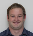 Nigel Drought has been employed as a Hydrographer for Thiess Environmental Monitoring since 2009. After graduating from the University of Otago with a Bachelor of Science Nigel (despite his last name) got offered a position of Assistant Hydrographer with Thiess Environmental Monitoring in Geelong, Victoria. From this moment Nigel has continually shown development of his Hydrographic knowledge and is a very well respected member of the Thiess Hydrographic community. His main roles over the past 5 years has been the routine data collection and subsequent data processing for the Department of Environment and Primary Industries monitoring network. When dealing with client’s Nigel’s personable character has allowed for a good rapport and productive client relationships. Due to his previous experience in remediation, at the start of 2014 Nigel took up an opportunity to relocate to Sydney to undertake groundwater testing for a service station chain. Through his strong work, initiative and logical thinking this sampling program has derived generous improvement from its conception.
Low infiltration sewer systems and their role in reducing wet weather sewage overflows within the Sydney Basin
Abstract
Rain induced sewer infiltration can increase flows in a sewerage system by ten times, far exceeding the designed capacity, resulting in wet weather sewage overflows into receiving waterways. This type of event is detrimental to the environment and water authorities around the world have been trying for decades to reduce or eliminate sewer infiltration. Studies show during wet weather induced sewage overflows oxygen depletion occurs due to the biodegradation of organic matter as the sewage is untreated which is a major cause of the phenomenon known as fish kills. An increase in the concentration of some organic micro-pollutants, metal concentrations and pathogenic/ faecal indicator micro-organisms and turbidity also occurs which leads to a reduction of photosynthetic primary production.
Although these negative effects on the rivers health are limited in duration due to processes such as sedimentation, dilution and decay the results justify all efforts made in reducing wet weather sewage overflows. Sydney Water has recently implemented a technical specification for low infiltration sewer (LIS) systems with the intent of minimising the effect infiltration has on a sewer network. LIS systems are defined as being constructed of polyvinylchloride, polypropylene or glass reinforced plastic with rubber ring joints or solvent weld joints. Due to the expectation of negligible amounts of inflow and infiltration the sewer pipes are constructed to accommodate only as much as three times peak dry weather flow which makes the pipes smaller than pipes within a sewerage system constructed to comply with the Water Services Association Australia, Sewerage Code of Australia, Sydney Water Edition. As such a unique feature of this design stipulates maintenance structures shall not be more than 180 m apart to allow for the clearing of any potential blockages. A three part monitoring plan was formulated to firstly establish sewer infiltration as an issue and to secondly assess the performance of Sydney Waters LIS system prior to any dwellings being constructed and thirdly after all dwelling construction had finished.
The preliminary results confirm sewer infiltration is an issue within the Sydney basin, and suggest the LIS systems being implemented by Sydney water are effective at reducing infiltration. The aim of this paper is to establish sewer infiltration as an environmental issue and to ascertain whether low infiltration sewer systems within the Sydney basin are operating as intended.
Bio
 Chris Harris commenced working for Sydney Water in 2007 as an Assistant Hydrographer and won the position of Hydrographer in 2010. His role as Hydrographer involves the monitoring, collection and analysing of sewerage Level, velocity and flow data in sewers throughout the Sydney basin. During his career at Sydney Water he has been involved in several projects, the most recent being the ‘Leak Tight Sewer Program.’
Over the past 6 years he has been studying Environmental Science majoring in Natural Resource Management through Southern Cross University and is currently working on the last subject towards his Bachelor Degree. He hopes to use his degree to further his career in the Water Industry. He plans to further his studies by commencing a double Diploma of Business and Management in the near future.
When not at work or study he enjoys spending time with his family, camping, fishing, 4WDing and being outdoors.
Evolving Technology, Methodology, Geomorphology and identifying changes in high stage ratings
Abstract
This paper’s purpose is to demonstrate issues that were generated after significant flooding in the Murrumbidgee highlighted significant differences between the gauged flow and the available rated flow. It will aim to outline how the differences may have come about as well as identifying the impacts on other organisations. It will aim at displaying how the data was utilised during the flood and post flood. It will also identify a future direction to be undertaken. In 2010 and 2012 there were significant flooding events in the Murrumbidgee with the later resulting in significant damage in Wagga and surrounding areas. The last time that the area had a similar sized event(s) was in 1974/75. These earlier events were measured by the Hydrographers at the time around their peak and a high stage rating was created. This high stage rating had been applied to all subsequent ratings and was thought to be valid as it was accepted that high stage ratings were stable and unlikely to significantly change over time.
Fast forward to 2010 and 2012 and the measurements made at comparable heights to the 74/75 floods yielded far less water for the same height. WHY?
Was this real? and the question that the councils had were what was the height going to be if a similar amount of water was to come. The Wagga Wagga council is currently going through a process of upgrading its flood levees at some significant expense, so you can see their angst at making sure the level applied, corresponds with their acceptable level of risk and not lower.
There had been many changes over 40 years, in not only how we now operate as Hydrographers but in the Catchment Morphology. The original gaugings were taken by current meters and from bridges, whilst the later measurements were taken using Acoustic Current Doppler Profile technology in a moving boat. There had also been significant changes in the catchments over the last 40 years. There has been revegetation of riparian areas and flood plains that had once been cleared for farming, this may have been legislatively driven for environmental benefits. There had also been many civil changes to the flow line with new bridges, flood levees, quarries and golf courses etc that may or may not have had an impact on why there was a difference.
So the task of validating if the measurements both in 1974/75 and in 2010/2012 were accurate and to identify whether the catchment changes were significant enough to alter the flood flow dynamic. Another point of interest was at what point was the change if real, as it will have a significant impact on the total flow of the Murrumbidgee over the last 40 years.
Bio
 Adam graduated from the University of Canberra in 1998 with an Undergraduate Degree in Ecology and Environmental Science. On returning back home to Batemans Bay with newly acquired qualifications, he found myself doing volunteer work at the local Botanic Gardens and unloading transport trucks as it was not an easy transition to a career position where he could apply his skills.
He came across recruitment advertisements from the NSW Department of Land and Water Conservation, for Cadet Hydrographer positions Dubbo/ Forbes in Central Western NSW. As it turned out he was unsuccessful in either of these positions but was offered a 3 month temporary position which rolled on for 12 months until he secured a permanent position in Orange where he stayed for another 12 months. He then took a sideways step within the department and transferred to a vacant position in Bega. This decision saw him working alongside his mentor Paul Corbett for over 10 years.
His time in Bega has seen him progress from a Cadet/Assistant Hydrographer to Hydrographer to Supervising Hydrographer to Hydrometric Coordinator. This time in Bega had mostly exposed him to monitoring coastal catchments so the approach to flood measurement and reporting was different to West of the divide. The role of Hydrometric Coordinator, which he has held for a couple of years now, has provided a baptism of fire into the intricacies of measuring the Murrumbidgee and the associated issues that it encompasses.
Assessing Performance Below the Ground
Abstract
Asset Managers face the long standing problem of groundwater and stormwater entering the gravity pipes of sewerage reticulation systems, known as Inflow and infiltration (I/I). Often there is an initial qualitative assessment of sewer performance based on the number of sewage overflows, the number of public complaints or the consequences of sewage treatment plants being under capacity during wet weather events.
To effectively manage I/I it is essential to be able to quantify sewer performance. Hydrography in the sewer systems has many challenges but these obstacles can be overcome by understanding the behaviour of sewage flow at each individual site and knowing the limitations of the equipment. This paper will review five local Councils across NSW that have undertaken sewer flow and rainfall monitoring and I/I analysis and how the data collected was used to assess targets and inform remedial measures.
Bio
 Sarah-Kate Dakin is a professional hydrographer that has been working for NSW Public Works for the past 9 years. Sarah-Kate specialises in flow and rainfall monitoring, inflow and infiltration analysis and GIS mapping.
Rainfall and Oil
Abstract
The need to adjust intensity gauge rainfall totals to storage gauge rainfall totals is recommended by the New Zealand ‘National Environmental Monitoring Standards’. Recent drought events in New Zealand over the summer period of 2013 and 2014 are suspected of causing evaporation from Octapent storage gauge devices. Is their design sufficient in certain environmental conditions to prevent significant evaporation? Hydrologist must guarantee their data or the long term rainfall statistics will be jeopardised. Will the addition of environmentally safe and easy to use oil prevent any evaporation and improve data quality.
Bio
Nicholas Holwerda – Environmental Specialist Hydrology, Auckland Council New Zealand.
After graduating the University of Waikato New Zealand with a BSc. Nicholas succeeded in gaining employment at the Waikato territorial authority. His role included data collection, management and analysis in hydrology, water quality, marine and lakes. After 2 years in this role he left New Zealand on his big overseas experience with partner Meagan, travelling all over Europe, Canada, and Asia. Returning to Auckland New Zealand in mid-2010, he gained employment in his current role of 4 years as an Environmental Specialist Hydrology. This diverse role covers all aspects of hydrological monitoring from data collection, management, archiving, analysis and reporting. Recently Nicholas gained a Diploma in Field Hydrology.
Friday 31 October
Friday 09:00 Field trip
RiverPro Demonstration – Ryde Wharf
Abstract
Teledyne RDI representatives will be in Australia to demonstrate the shallow river specific RiverPro – the newest member of the growing RDI family of ADCPs for inland Water Resources applications.
The 1200 kHz RiverPro intelligent river discharge measurement system is most suitable for Australian river applications:
- Shallow water specific with a 0.2 to 20 m profiling range
- More effective in shallow water (less than 2 m) due to the 1200kHz operating frequency
- 20 degree beam angle with only a 6% side lobe region
The RiverPro will provide higher velocity measurement precision (smaller standard deviation) and higher special resolution (small cell size) because it is a 1200 kHz system. It also includes a vertical beam with calibrated RSSI for sediment studies. Finally, RiverPro has an embedded GPS for geo reference.
The demonstration will be conducted prior to the Scenic Sydney Harbour Cruise. Join us from 8:00am at Ryde Wharf where the coffee is on UVS and Teledyne RDI.
Contact
Contact Jen Benson at UVS for further information on 02 4964 3514
Friday 10:00-14:30 Field trip: Harbour Cruise
Onboard presentation: Various Sites around Sydney Harbour including Goat Island
Abstract
We will be pointing out locations where Sydney Water (in conjunction with Oceanographic Field Services Pty Ltd and MHL) conducted concurrent Acoustic Doppler Current Profiles (ADCP) transects, conductivity / temperature / depth (CTD) profiles and water quality (dissolved oxygen, pH and turbidity) profiles in the main river channel of the Parramatta River, Lane Cove River, Sydney Harbour and Middle Harbour. Two surveys were conducted – one in dry weather (seven sites in total) and one following a wet weather event (twelve sites in total). An instrument mooring comprising of one bottom mounted ADCP, vertical string of four high resolution CTDs (two of these with turbidity sensors) and a SL60 navigation marker was also deployed near Goat Island for four months. Natalie will discuss all the methods and equipment used, why the data was collected, and the results so far.
Speaker bio

Natalie is an Assistant Hydrographer in the Special Projects and Instrumentation Group at Sydney Water where she delivers and reports hydrometric, bathymetric, scientific, and environmental data to key Sydney Water stakeholders and external clients.
Natalie started with Sydney Water on the Graduate Program in 2010 after completing her Bachelor of Science (environmental) at Sydney University. The graduate program gave her exposure to various business areas within Sydney Water and to external clients. These business areas include Environmental Planning and Management, Aquatic Ecology, and Field Sampling. She is currently enrolled in the Water Operations Diploma, and has had various other businesses training over the years through Chifley Business School, such as Presentation Skills, Accounting, Project Management, Communication with Influence and Auditing EMS.
Her main interest and enthusiasm for water monitoring and hydrography became apparent after obtaining a position in the Special Projects and Instrumentation group. Natalie has been trained and mentored by Tony Polchleb. Some of the most memorable experiences include surveying and operating hydrometric sites along 300 kilometres of the Hawkesbury-Nepean River System, Chichester Dam, and more recently Parramatta River, Lane Cove River, Sydney Harbour, Georges River, Cooks River and Botany Bay.
Friday 10:00-14:30 Field trip: Harbour Cruise
Fort Denison
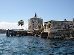 Fort Denison © 2006 Andy Mitchell CC BY-SA
Abstract
A former defence facility, Fort Denison is an icon of Sydney Harbour. Previously known as “Mat-te-wan-ye”, “Rock Island” and “Pinchgut”, it serves as a rich reminder to Australia’s colonial and convict history. It receives over 7000 visitors per year, with tours being run by NSW National Parks and Wildlife Service. The tours cover the museum, cannons’ gun powder store and famous winding stair case. The tour also incorporates the fully operational tide gauge room where Sydney’s tidal benchmark is recorded.
This tide gauge room houses one of the worlds longest continuous tide gauge recording facilities, which was first established on the island in the 1860s. There are currently two tide gauges on the Fort, the modern electric gauge and the early gauge installed in 1908 which is still in operating order.
Friday 10:00-14:30 Field trip: Harbour Cruise
Onboard presentation: Integrated marine observing system
Abstract
Moninya Roughan is a physical oceanographer and lecturer at the University of NSW and will speak to the group on her work with the Integrated Marine Observing System (IMOS) and ocean observing. IMOS is designed as a fully-integrated national array of observing equipment to monitor the open oceans and coastal marine environment around Australia, covering physical, chemical and biological variables. Moninya recently stepped down from her position as Co- leader of the NSW IMOS Node, but remains actively involved in the continuation of the program, particularly with the mooring and ocean glider systems.
Dr Moninya Roughan
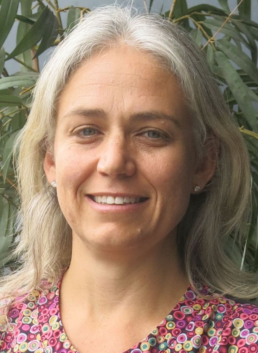 Dr Moninya Roughan is a physical oceanographer with expertise in coastal and continental shelf dynamics. Moninya’s research focuses on improving dynamical understanding of the coastal ocean including physical forcings, nutrient enrichment processes and their biological impact. Moninya uses a combination of observations and numerical models to study the oceanography of the East Australian Current and its impact on the continental shelf and she coordinates research in this field. Moninya has over 50 publications including peer-reviewed journal papers, book chapters, international conference papers, consultancies and technical reports. Her work has been funded by a variety sources including the Australia Research Council, a variety of Australian Federal and State Government programmes, the US Office of Naval Research and private consultancies.
Visit her website for more information www.oceanography.unsw.edu.au
Sydney Harbour Research Program harbourprogram.sims.org.au
Integrated Marine Observing System www.imos.org.au
Source: UNSW
Friday 10:00-14:30 Field trip: Harbour Cruise
Onboard presentation: Recent work by Manly Hydraulics Laboratory in Sydney Harbour
Abstract
Ed’s experience in the industry especially around Sydney Harbour make him an interesting and informed speaker for the field trip. He will cover recent work done in and around the harbour and the reasons behind and benefit of these works.
Speaker bio
 Ed is the Principal Engineer at NSW Public Works MHL. He has over twenty years’ experience in coastal, estuarine and other water engineering studies, having held numerous senior positions responsible for large multi-disciplinary teams including GHD Service Line Leader for Integrated Water Management, Sydney Water’s Monitoring Information Systems, Hydrometric Services, Science and Technology and System Services Groups. Ed previously led the Coasts and Estuaries Group at the Water Research Laboratory. Ed specialises in coastal, estuarine and riverine physical processes. He has led numerous Australian and international investigations (including Singapore, Malaysia, Thailand, China, New Zealand, Argentina) and has been involved with several major and award winning projects including physical modelling studies associated with Sydney’s deepwater ocean outfalls that won two Engineering Excellence Awards (for Research and Development, and for the Environment).

